Jilikŭl night lights from space
Night Light of Jilikŭl (Khatlon) from space (Tajikistan) Src. Average luminocity for 10x10km area is 0.7435% and for 50x50km: 0.1549%.
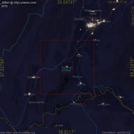
Analysis of Jilikŭl night lights 2016
Square area 10x10 km:
 0%
0%90-99
0%80-89
0%70-79
0.16%60-69
0.49%50-59
0%40-49
0%30-39
0%20-29
0.65%10-19
0%0-9
98.7%Square area 50x50 km:
0%90-99
0%80-89
0.01%70-79
0.03%60-69
0.02%50-59
0.07%40-49
0.03%30-39
0.05%20-29
0.07%10-19
0.03%0-9
99.67%Clear (daylight) street map image can be seen on geolist.org.
Map coordinates:
38° 2' 50.9" North, 67° 49' 40.6" East
37° 29' 30" North, 68° 31' 51.8" East
36° 55' 54.1" North, 69° 14' 3.1" East
Some cities around Jilikŭl sort by population:
• Qarāwul, AF
37.4 km =23.2 mi,  143°
143°
• Moskovskiy
13.8 km =8.6 mi,  18°
18°
• Kolkhozobod
15.6 km =9.7 mi,  46°
46°
• Vakhsh
36.5 km =22.7 mi, 47°
• Shahritus
43.1 km =26.8 mi,  233°
233°
• Dŭstí
19.8 km =12.3 mi, 143°
• Gharavŭtí
11.2 km =7 mi,  318°
318°
• Orzu
26.5 km =16.5 mi,  73°
73°
1221808 (p: 5,434)
Sources (retrieved 2019-11-25):
» Earth at Night: Flat Maps 2012, 2016