Kalasin night lights from space
Night Light of Kalasin from space (Thailand) Src. Average luminocity for 10x10km area is 42.6012% and for 50x50km: 6.8523%.
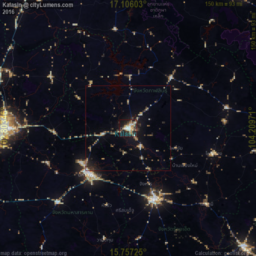
Analysis of Kalasin night lights 2016
Square area 10x10 km:
 3.93%
3.93%90-99
9.92%80-89
7.02%70-79
7.44%60-69
4.75%50-59
2.89%40-49
5.37%30-39
8.26%20-29
9.5%10-19
36.16%0-9
4.75%Square area 50x50 km:
0.25%90-99
0.95%80-89
1%70-79
0.88%60-69
0.66%50-59
0.52%40-49
1.38%30-39
1.42%20-29
1.8%10-19
4.94%0-9
86.2%Clear (daylight) street map image can be seen on geolist.org.
Map coordinates:
17° 6' 21.7" North, 102° 48' 12.5" East
16° 25' 58.1" North, 103° 30' 23.7" East
15° 45' 26.1" North, 104° 12' 35" East
Some cities around Kalasin sort by population:
• Maha Sarakham
35.3 km =21.9 mi,  218°
218°
• Roi Et
44.6 km =27.7 mi,  159°
159°
• Kamalasai
12.8 km =8 mi,  144°
144°
• Nong Kung Si
32.7 km =20.3 mi,  317°
317°
• Pho Chai
30.4 km =18.9 mi,  112°
112°
• Yang Talat
15.2 km =9.4 mi,  256°
256°
• Huai Mek
33.8 km =21 mi,  301°
301°
• Kosum Phisai
51.1 km =31.8 mi,  246°
246°
1610469 (p: 55,102)
Sources (retrieved 2019-11-25):
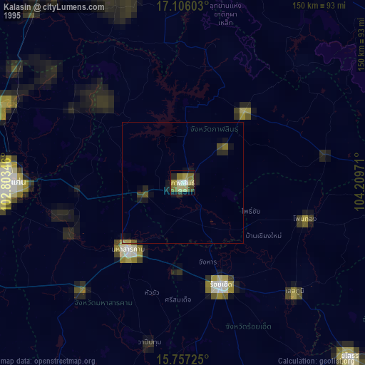
» NASA, Earths city lights 1995
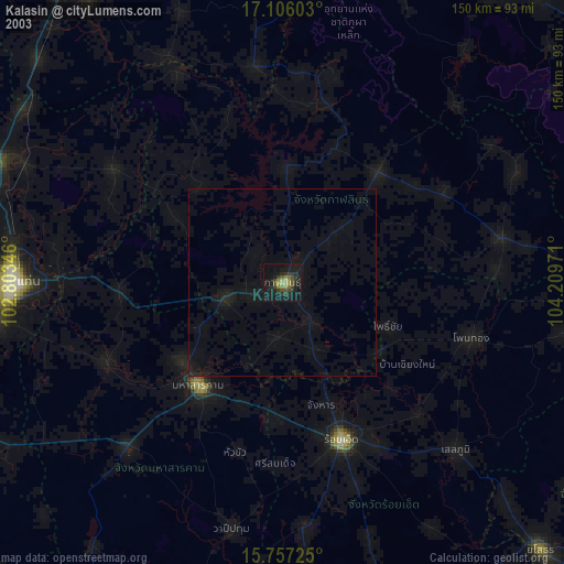
» NASA city lights 2003
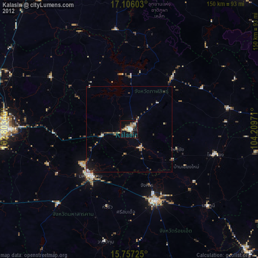
» Earth at Night: Flat Maps 2012, 2016