Videm night lights from space
Night Light of Videm (Dobrepolje) from space (Slovenia) Src. Average luminocity for 10x10km area is 0.003% and for 50x50km: 3.8863%.
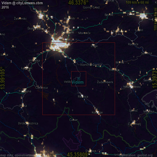
Analysis of Videm night lights 2016
Square area 10x10 km:
 0%
0%90-99
0%80-89
0%70-79
0%60-69
0%50-59
0%40-49
0%30-39
0%20-29
0%10-19
0%0-9
100%Square area 50x50 km:
0.84%90-99
0.86%80-89
0.36%70-79
0.25%60-69
0.25%50-59
0.58%40-49
0.46%30-39
0.52%20-29
1.25%10-19
2.12%0-9
92.52%Clear (daylight) street map image can be seen on geolist.org.
Map coordinates:
46° 20' 15.4" North, 13° 59' 27.8" East
45° 51' 0" North, 14° 41' 39" East
45° 21' 29.1" North, 15° 23' 50.3" East
Some cities around Videm sort by population:
• Grosuplje
12.1 km =7.5 mi,  346°
346°
• Ribnica
12.7 km =7.9 mi,  168°
168°
• Škofljica
17.4 km =10.8 mi,  328°
328°
• Ivančna Gorica
13 km =8.1 mi,  40°
40°
• Sodražica
10.9 km =6.8 mi,  204°
204°
• Velike Lašče
4.9 km =3 mi,  246°
246°
• Hrib-Loški Potok
17 km =10.6 mi, 200°
• Nova Vas
17 km =10.6 mi,  239°
239°
3187813 (p: 577)
Sources (retrieved 2019-11-25):
» Earth at Night: Flat Maps 2012, 2016