Cirkulane night lights from space
Night Light of Cirkulane from space (Slovenia) Src. Average luminocity for 10x10km area is 1.1815% and for 50x50km: 4.5201%.
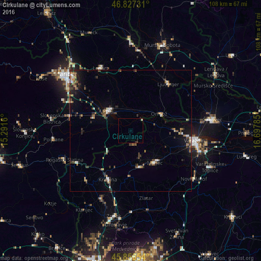
Analysis of Cirkulane night lights 2016
Square area 10x10 km:
 0%
0%90-99
0.6%80-89
0%70-79
0%60-69
0%50-59
0%40-49
0.3%30-39
0.3%20-29
0.6%10-19
0.6%0-9
97.62%Square area 50x50 km:
0.37%90-99
0.5%80-89
0.31%70-79
0.46%60-69
0.65%50-59
0.85%40-49
0.88%30-39
0.83%20-29
1.23%10-19
2.31%0-9
91.62%Clear (daylight) street map image can be seen on geolist.org.
Map coordinates:
46° 49' 38.3" North, 15° 17' 29.8" East
46° 20' 38.7" North, 15° 59' 41" East
45° 51' 23.5" North, 16° 41' 52.3" East
Some cities around Cirkulane sort by population:
• Ptuj
12.8 km =8 mi,  311°
311°
• Dornava
10.8 km =6.7 mi,  342°
342°
• Gorišnica
8 km =5 mi,  10°
10°
• Videm pri Ptuju
7.3 km =4.5 mi,  291°
291°
• Markovci
7.7 km =4.8 mi,  318°
318°
• Podlehnik
8.9 km =5.5 mi,  263°
263°
• Spodnja Hajdina
13.4 km =8.3 mi,  302°
302°
• Zavrč
6.8 km =4.2 mi,  38°
38°
6956384 (p: 434)
Sources (retrieved 2019-11-25):
» Earth at Night: Flat Maps 2012, 2016