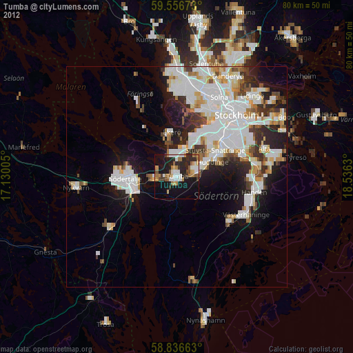
Tumba night lights from space
Night Light of Tumba (Stockholm) from space (Sweden) Src. Average luminocity for 10x10km area is 54.7732% and for 50x50km: 29.2063%.
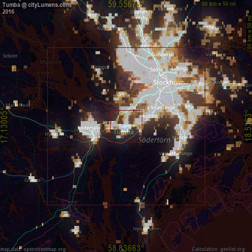
Analysis of Tumba night lights 2016
Square area 10x10 km:
100  14.4%
14.4%
90-99 12.7%
80-89 5.9%
70-79 6.12%
60-69 3.97%
50-59 6.12%
40-49 5.1%
30-39 8.16%
20-29 20.63%
10-19 16.67%
0-9 0.23%
14.4%90-99
12.7%80-89
5.9%70-79
6.12%60-69
3.97%50-59
6.12%40-49
5.1%30-39
8.16%20-29
20.63%10-19
16.67%0-9
0.23%Square area 50x50 km:
100 10.33%
90-99 7.59%
80-89 2.03%
70-79 2.38%
60-69 1.98%
50-59 2.06%
40-49 2.33%
30-39 3.16%
20-29 5.41%
10-19 8.89%
0-9 53.83%
10.33%90-99
7.59%80-89
2.03%70-79
2.38%60-69
1.98%50-59
2.06%40-49
2.33%30-39
3.16%20-29
5.41%10-19
8.89%0-9
53.83%Clear (daylight) street map image can be seen on geolist.org.
Map coordinates:
59° 33' 24.2" North, 17° 7' 48.2" East
59° 11' 54.9" North, 17° 49' 59.4" East
58° 50' 11.9" North, 18° 32' 10.7" East
Some cities around Tumba sort by population:
• Huddinge
9.5 km =5.9 mi,  63°
63°
• Södertälje
11.8 km =7.3 mi,  268°
268°
• Tullinge
3.8 km =2.4 mi,  87°
87°
• Ekerö
10.3 km =6.4 mi,  353°
353°
• Alby
4.1 km =2.5 mi,  16°
16°
• Segeltorp
10.2 km =6.3 mi,  32°
32°
• Vårby
8.1 km =5 mi, 20°
• Fittja
5.8 km =3.6 mi, 15°
2667094 (p: 40,832)
Sources (retrieved 2019-11-25):
» Earth at Night: Flat Maps 2012, 2016