Järna night lights from space
Night Light of Järna (Stockholm) from space (Sweden) Src. Average luminocity for 10x10km area is 9.8923% and for 50x50km: 11.7953%.
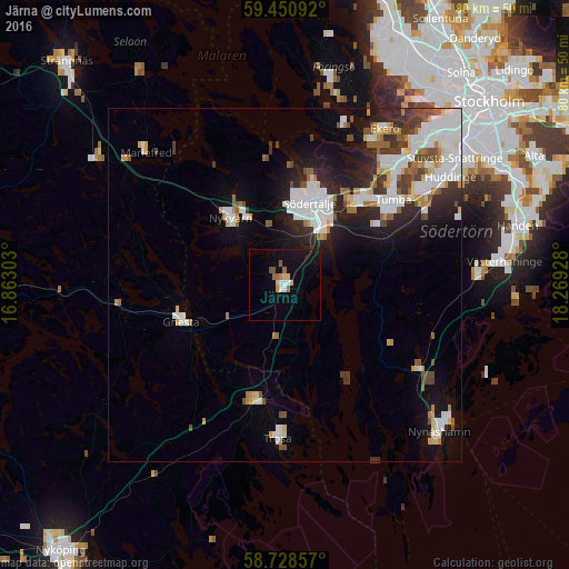
Analysis of Järna night lights 2016
Square area 10x10 km:
100  0.68%
0.68%
90-99 1.59%
80-89 1.81%
70-79 0.91%
60-69 1.02%
50-59 1.93%
40-49 0.23%
30-39 0%
20-29 0%
10-19 8.5%
0-9 83.33%
0.68%90-99
1.59%80-89
1.81%70-79
0.91%60-69
1.02%50-59
1.93%40-49
0.23%30-39
0%20-29
0%10-19
8.5%0-9
83.33%Square area 50x50 km:
100 3.13%
90-99 2.62%
80-89 0.99%
70-79 0.97%
60-69 0.93%
50-59 1.12%
40-49 1.1%
30-39 1.34%
20-29 2.82%
10-19 5.89%
0-9 79.09%
3.13%90-99
2.62%80-89
0.99%70-79
0.97%60-69
0.93%50-59
1.12%40-49
1.1%30-39
1.34%20-29
2.82%10-19
5.89%0-9
79.09%Clear (daylight) street map image can be seen on geolist.org.
Map coordinates:
59° 27' 3.3" North, 16° 51' 46.9" East
59° 5' 29.9" North, 17° 33' 58.1" East
58° 43' 42.9" North, 18° 16' 9.4" East
Some cities around Järna sort by population:
• Södertälje
12 km =7.5 mi,  16°
16°
• Tumba
19.3 km =12 mi,  52°
52°
• Tullinge
22.5 km =14 mi,  57°
57°
• Alby
22.7 km =14.1 mi, 46°
• Fittja
24.2 km =15 mi,  43°
43°
• Nykvarn
12.2 km =7.6 mi,  321°
321°
• Trosa
21.8 km =13.5 mi,  182°
182°
• Gnesta
15.3 km =9.5 mi,  251°
251°
2703269 (p: 6,038)
Sources (retrieved 2019-11-25):
» Earth at Night: Flat Maps 2012, 2016