Avesta night lights from space
Night Light of Avesta (Dalarna) from space (Sweden) Src. Average luminocity for 10x10km area is 24.2149% and for 50x50km: 3.8243%.
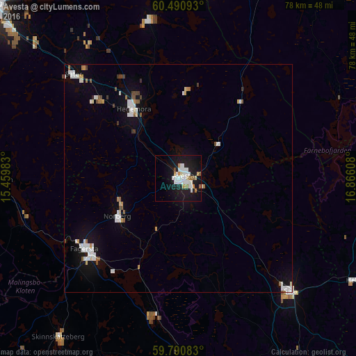
Analysis of Avesta night lights 2016
Square area 10x10 km:
 5.99%
5.99%90-99
7.13%80-89
1.14%70-79
1.86%60-69
2.07%50-59
1.45%40-49
0.62%30-39
0%20-29
3%10-19
32.64%0-9
44.11%Square area 50x50 km:
0.92%90-99
0.88%80-89
0.2%70-79
0.25%60-69
0.31%50-59
0.29%40-49
0.3%30-39
0.19%20-29
0.14%10-19
3.01%0-9
93.49%Clear (daylight) street map image can be seen on geolist.org.
Map coordinates:
60° 29' 27.3" North, 15° 27' 35.4" East
60° 8' 33.9" North, 16° 9' 46.6" East
59° 47' 27" North, 16° 51' 57.9" East
Some cities around Avesta sort by population:
• Borlänge
55.2 km =34.3 mi,  313°
313°
• Ludvika
54 km =33.6 mi,  270°
270°
• Sala
34.9 km =21.7 mi,  135°
135°
• Fagersta
25.7 km =16 mi,  233°
233°
• Hedemora
18 km =11.2 mi,  327°
327°
• Surahammar
48.5 km =30.1 mi,  176°
176°
• Hofors
45.3 km =28.1 mi,  8°
8°
• Smedjebacken
41.4 km =25.7 mi, 269°
2724231 (p: 11,949)
Sources (retrieved 2019-11-25):
» Earth at Night: Flat Maps 2012, 2016