Yelets night lights from space
Night Light of Yelets (Lipetsk Oblast) from space (Russia) Src. Average luminocity for 10x10km area is 39.828% and for 50x50km: 2.4445%.
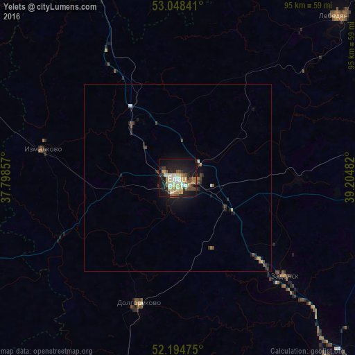
Analysis of Yelets night lights 2016
Square area 10x10 km:
 3.17%
3.17%90-99
8.47%80-89
8.86%70-79
4.1%60-69
5.16%50-59
5.95%40-49
5.42%30-39
3.97%20-29
8.73%10-19
34.39%0-9
11.77%Square area 50x50 km:
0.17%90-99
0.37%80-89
0.39%70-79
0.21%60-69
0.29%50-59
0.35%40-49
0.43%30-39
0.38%20-29
0.69%10-19
2.17%0-9
94.54%Clear (daylight) street map image can be seen on geolist.org.
Map coordinates:
53° 2' 54.3" North, 37° 47' 54.9" East
52° 37' 25.2" North, 38° 30' 6.1" East
52° 11' 41.1" North, 39° 12' 17.4" East
Some cities around Yelets sort by population:
• Yefremov
64.3 km =40 mi,  335°
335°
• Lebedyan’
62.7 km =39 mi,  45°
45°
• Zadonsk
38.7 km =24 mi,  132°
132°
• Terbuny
54.8 km =34.1 mi,  195°
195°
• Khlevnoye
62.3 km =38.7 mi,  139°
139°
• Borinskoye
61.7 km =38.3 mi,  107°
107°
• Dolgorukovo
35.4 km =22 mi, 197°
• Stanovoye
18.3 km =11.4 mi,  328°
328°
467978 (p: 115,688)
Sources (retrieved 2019-11-25):
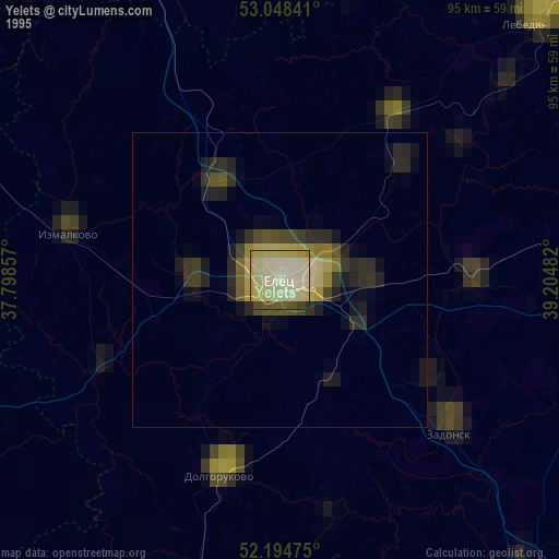
» NASA, Earths city lights 1995
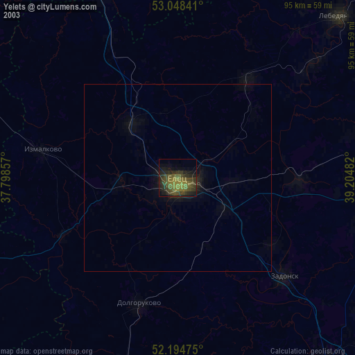
» NASA city lights 2003
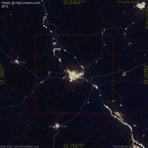
» Earth at Night: Flat Maps 2012, 2016