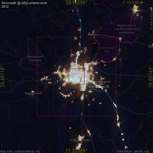
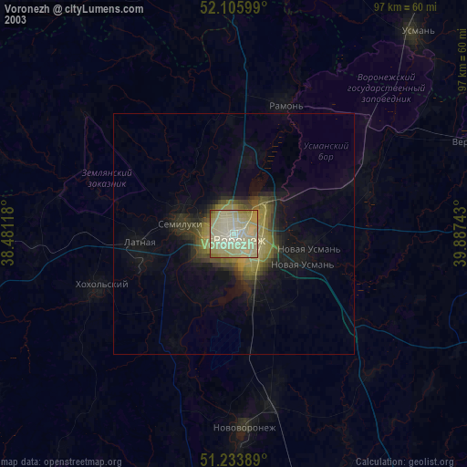
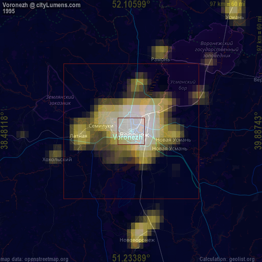
Voronezh night lights from space
Night Light of Voronezh (Voronezj) from space (Russia) Src. Average luminocity for 10x10km area is 91.1807% and for 50x50km: 13.8038%.
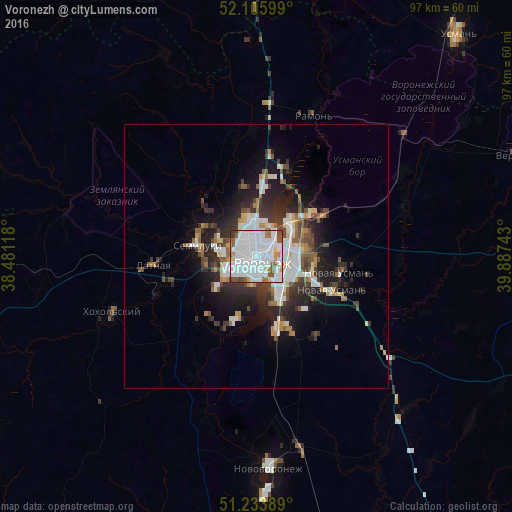
Analysis of Voronezh night lights 2016
Square area 10x10 km:
 63.31%
90-99
15.13%80-89
3.08%70-79
3.5%60-69
3.78%50-59
4.9%40-49
4.62%30-39
1.68%20-29
0%10-19
0%0-9
0%Square area 50x50 km:
4.08%90-99
2.37%80-89
0.9%70-79
1.05%60-69
1.32%50-59
1.45%40-49
1.83%30-39
2.23%20-29
4.28%10-19
6.98%0-9
73.52%Clear (daylight) street map image can be seen on geolist.org.
Map coordinates:
52° 6' 21.6" North, 38° 28' 52.2" East
51° 40' 19.3" North, 39° 11' 3.5" East
51° 14' 2" North, 39° 53' 14.7" East
Some cities around Voronezh sort by population:
• Semiluki
10.9 km =6.8 mi,  277°
277°
• Novaya Usman’
15.8 km =9.8 mi,  102°
102°
• Pridonskoy
7.8 km =4.8 mi, 279°
• Somovo
14.7 km =9.1 mi,  58°
58°
• Podgornoye
7.4 km =4.6 mi,  341°
341°
• Maslovka
13.7 km =8.5 mi,  164°
164°
• Latnaya
19.6 km =12.2 mi,  265°
265°
• Shilovo
15.5 km =9.6 mi,  205°
205°
472045 (p: 848,752)
Sources (retrieved 2019-11-25):
» NASA, Earths city lights 1995
» NASA city lights 2003
» Earth at Night: Flat Maps 2012, 2016