Uchkeken night lights from space
Night Light of Uchkeken (Karachayevo-Cherkesiya Republic) from space (Russia) Src. Average luminocity for 10x10km area is 11.4524% and for 50x50km: 2.7462%.
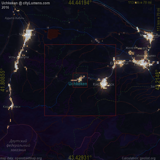
Analysis of Uchkeken night lights 2016
Square area 10x10 km:
 0%
0%90-99
0.63%80-89
0%70-79
1.9%60-69
3.81%50-59
4.76%40-49
2.54%30-39
1.27%20-29
1.27%10-19
0.16%0-9
83.65%Square area 50x50 km:
0.42%90-99
0.51%80-89
0.17%70-79
0.33%60-69
0.29%50-59
0.37%40-49
0.34%30-39
0.21%20-29
0.37%10-19
2.31%0-9
94.67%Clear (daylight) street map image can be seen on geolist.org.
Map coordinates:
44° 26' 31" North, 41° 48' 30.8" East
43° 56' 16" North, 42° 30' 42" East
43° 25' 45.5" North, 43° 12' 53.3" East
Some cities around Uchkeken sort by population:
• Kislovodsk
17 km =10.6 mi,  99°
99°
• Yessentuki
30.3 km =18.8 mi,  66°
66°
• Yessentukskaya
31.4 km =19.5 mi, 70°
• Suvorovskaya
30.4 km =18.9 mi,  22°
22°
• Vinsady
39.6 km =24.6 mi, 66°
• Tereze
5.5 km =3.4 mi,  268°
268°
• Pervomayskoye
2.9 km =1.8 mi, 271°
• Yasnaya Polyana
21.5 km =13.4 mi,  64°
64°
479687 (p: 15,118)
Sources (retrieved 2019-11-25):
» Earth at Night: Flat Maps 2012, 2016