Shalazhi night lights from space
Night Light of Shalazhi (Chechnya) from space (Russia) Src. Average luminocity for 10x10km area is 7.0182% and for 50x50km: 8.6869%.
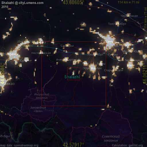
Analysis of Shalazhi night lights 2016
Square area 10x10 km:
 0.15%
0.15%90-99
0.45%80-89
0%70-79
1.21%60-69
0%50-59
1.21%40-49
3.03%30-39
1.52%20-29
3.33%10-19
0.45%0-9
88.64%Square area 50x50 km:
0.7%90-99
1.4%80-89
0.98%70-79
0.99%60-69
0.98%50-59
1.25%40-49
0.94%30-39
0.95%20-29
2.13%10-19
10.18%0-9
79.5%Clear (daylight) street map image can be seen on geolist.org.
Map coordinates:
43° 36' 21.8" North, 44° 39' 21.1" East
43° 5' 41.1" North, 45° 21' 32.3" East
42° 34' 45" North, 46° 3' 43.6" East
Some cities around Shalazhi sort by population:
• Urus-Martan
15.1 km =9.4 mi,  74°
74°
• Achkhoy-Martan
12.2 km =7.6 mi,  330°
330°
• Assinovskaya
21.7 km =13.5 mi,  318°
318°
• Gekhi
12 km =7.5 mi,  50°
50°
• Katyr-Yurt
8.6 km =5.3 mi,  5°
5°
• Valerik
10.3 km =6.4 mi,  22°
22°
• Martan-Chu
16.9 km =10.5 mi,  101°
101°
• Bamut
15 km =9.3 mi,  298°
298°
495969 (p: 5,319)
Sources (retrieved 2019-11-25):
» Earth at Night: Flat Maps 2012, 2016