Katyr-Yurt night lights from space
Night Light of Katyr-Yurt (Chechnya) from space (Russia) Src. Average luminocity for 10x10km area is 21.1364% and for 50x50km: 10.6872%.
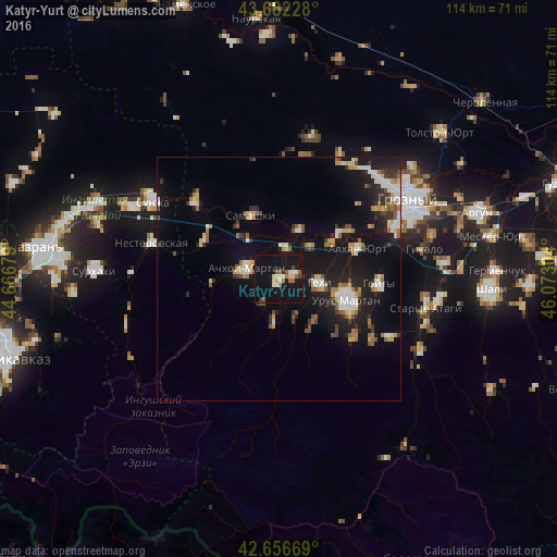
Analysis of Katyr-Yurt night lights 2016
Square area 10x10 km:
 1.21%
1.21%90-99
3.94%80-89
2.73%70-79
0.91%60-69
2.42%50-59
3.33%40-49
2.42%30-39
0.91%20-29
1.52%10-19
47.73%0-9
32.88%Square area 50x50 km:
0.99%90-99
1.88%80-89
1.15%70-79
1.18%60-69
1.14%50-59
1.41%40-49
1.11%30-39
1.3%20-29
2.76%10-19
11.77%0-9
75.31%Clear (daylight) street map image can be seen on geolist.org.
Map coordinates:
43° 40' 56.2" North, 44° 40' 0.4" East
43° 10' 17.9" North, 45° 22' 11.7" East
42° 39' 24.1" North, 46° 4' 22.9" East
Some cities around Katyr-Yurt sort by population:
• Urus-Martan
14.4 km =8.9 mi,  108°
108°
• Achkhoy-Martan
7.3 km =4.5 mi,  286°
286°
• Samashki
14.3 km =8.9 mi,  335°
335°
• Alkhan-Kala
16.8 km =10.4 mi,  54°
54°
• Gekhi
8.4 km =5.2 mi,  96°
96°
• Valerik
3.2 km =2 mi,  73°
73°
• Shalazhi
8.6 km =5.3 mi,  185°
185°
• Bamut
14.1 km =8.8 mi,  264°
264°
551729 (p: 9,202)
Sources (retrieved 2019-11-25):
» Earth at Night: Flat Maps 2012, 2016