Ryazanskaya night lights from space
Night Light of Ryazanskaya (Krasnodarskiy) from space (Russia) Src. Average luminocity for 10x10km area is 4.973% and for 50x50km: 3.6383%.
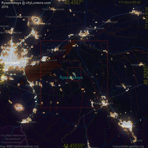
Analysis of Ryazanskaya night lights 2016
Square area 10x10 km:
 0%
0%90-99
0%80-89
0%70-79
1.27%60-69
1.43%50-59
0.95%40-49
2.54%30-39
1.59%20-29
1.11%10-19
0%0-9
91.11%Square area 50x50 km:
0.22%90-99
0.57%80-89
0.42%70-79
0.39%60-69
0.72%50-59
0.38%40-49
0.71%30-39
0.49%20-29
0.84%10-19
1.61%0-9
93.65%Clear (daylight) street map image can be seen on geolist.org.
Map coordinates:
45° 27' 2.5" North, 38° 53' 9" East
44° 57' 19" North, 39° 35' 20.2" East
44° 27' 20" North, 40° 17' 31.5" East
Some cities around Ryazanskaya sort by population:
• Belorechensk
30.7 km =19.1 mi,  131°
131°
• Ust’-Labinsk
29.5 km =18.3 mi,  15°
15°
• Vasyurinskaya
22.3 km =13.9 mi,  324°
324°
• Adygeysk
32.3 km =20.1 mi,  255°
255°
• Starokorsunskaya
24.3 km =15.1 mi,  297°
297°
• Dvubratskiy
35.8 km =22.2 mi,  28°
28°
• Krasnogvardeyskoye
19.2 km =11.9 mi,  356°
356°
• Velikovechnoye
13.3 km =8.3 mi,  100°
100°
500060 (p: 5,157)
Sources (retrieved 2019-11-25):
» Earth at Night: Flat Maps 2012, 2016