Parnas night lights from space
Night Light of Parnas (Leningradskaya Oblast') from space (Russia) Src. Average luminocity for 10x10km area is 93.9793% and for 50x50km: 42.0511%.
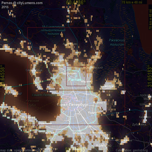
Analysis of Parnas night lights 2016
Square area 10x10 km:
 52.89%
90-99
27.27%80-89
8.37%70-79
5.48%60-69
3.93%50-59
0.21%40-49
1.76%30-39
0.1%20-29
0%10-19
0%0-9
0%Square area 50x50 km:
18.31%90-99
7.54%80-89
3.3%70-79
4.02%60-69
4.55%50-59
1.77%40-49
1.59%30-39
3.52%20-29
8.87%10-19
13.01%0-9
33.51%Clear (daylight) street map image can be seen on geolist.org.
Map coordinates:
60° 25' 7" North, 29° 38' 44.1" East
60° 4' 10.7" North, 30° 20' 55.3" East
59° 43' 1" North, 31° 3' 6.6" East
Some cities around Parnas sort by population:
• Ozerki
3.9 km =2.4 mi,  211°
211°
• Grazhdanka
4.9 km =3 mi,  140°
140°
• Sosnovka
5.9 km =3.7 mi,  179°
179°
• Kolomyagi
6.2 km =3.9 mi,  215°
215°
• Pargolovo
4.2 km =2.6 mi,  287°
287°
• Murino
6.2 km =3.9 mi,  112°
112°
• Bugry
2.4 km =1.5 mi,  85°
85°
• Shuvalovo
3.8 km =2.4 mi,  233°
233°
8504950 (p: 66,693)
Sources (retrieved 2019-11-25):
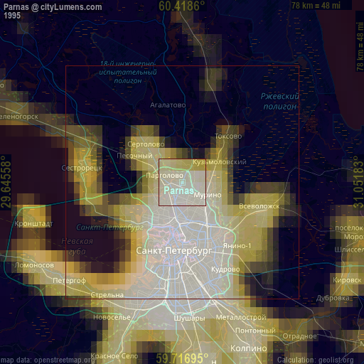
» NASA, Earths city lights 1995
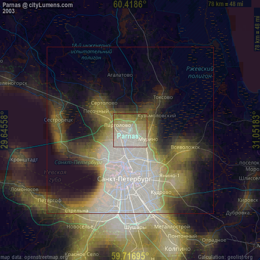
» NASA city lights 2003
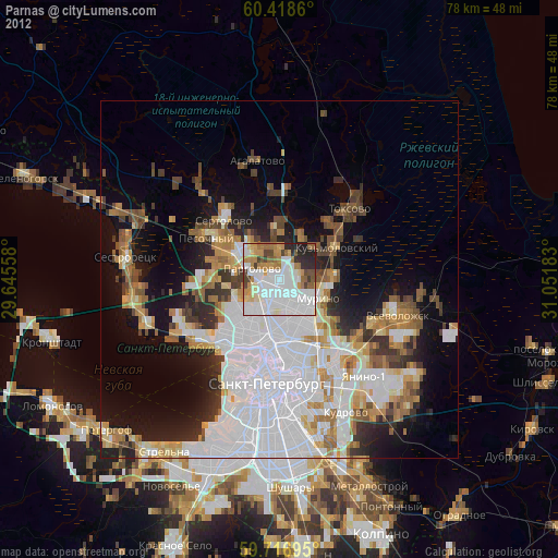
» Earth at Night: Flat Maps 2012, 2016