Novoaltaysk night lights from space
Night Light of Novoaltaysk (Altai Krai) from space (Russia) Src. Average luminocity for 10x10km area is 23.8082% and for 50x50km: 7.0467%.
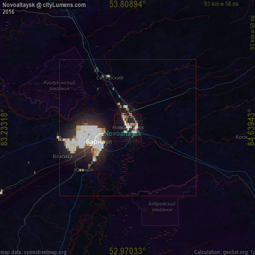
Analysis of Novoaltaysk night lights 2016
Square area 10x10 km:
 4.5%
4.5%90-99
3.97%80-89
1.72%70-79
1.32%60-69
2.51%50-59
4.63%40-49
3.57%30-39
2.25%20-29
4.76%10-19
23.02%0-9
47.75%Square area 50x50 km:
1.87%90-99
1.8%80-89
0.6%70-79
0.44%60-69
0.28%50-59
0.53%40-49
0.47%30-39
0.77%20-29
2.19%10-19
4.76%0-9
86.28%Clear (daylight) street map image can be seen on geolist.org.
Map coordinates:
53° 48' 32.2" North, 83° 13' 59.4" East
53° 23' 30.1" North, 83° 56' 10.7" East
52° 58' 13.2" North, 84° 38' 21.9" East
Some cities around Novoaltaysk sort by population:
• Barnaul
12 km =7.5 mi,  253°
253°
• Yuzhnyy
22.2 km =13.8 mi,  226°
226°
• Novosilikatnyy
22.7 km =14.1 mi, 246°
• Sibirskiy
23.8 km =14.8 mi,  330°
330°
• Beloyarsk
6.4 km =4 mi,  340°
340°
• Borovikha
14.4 km =8.9 mi, 333°
• Kosikha
43 km =26.7 mi,  94°
94°
• Pervomayskoye
37 km =23 mi,  8°
8°
1497173 (p: 61,050)
Sources (retrieved 2019-11-25):
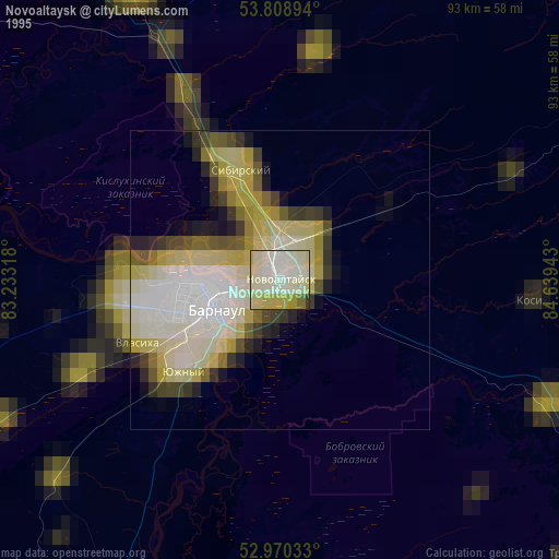
» NASA, Earths city lights 1995
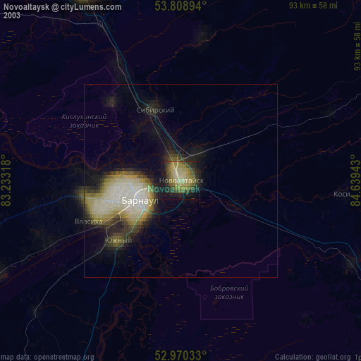
» NASA city lights 2003
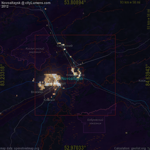
» Earth at Night: Flat Maps 2012, 2016