Maykop night lights from space
Night Light of Maykop (Adygeya Republic) from space (Russia) Src. Average luminocity for 10x10km area is 54.7985% and for 50x50km: 5.3466%.
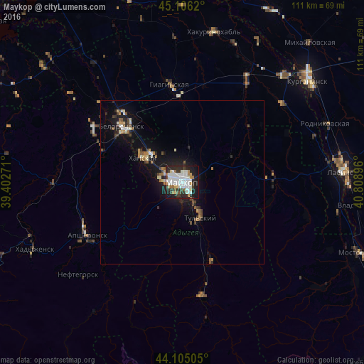

Analysis of Maykop night lights 2016
Square area 10x10 km:
 17.27%
90-99
16.67%80-89
2.42%70-79
5%60-69
3.48%50-59
2.42%40-49
2.73%30-39
9.24%20-29
19.24%10-19
20.3%0-9
1.21%Square area 50x50 km:
0.83%90-99
1.02%80-89
0.37%70-79
0.55%60-69
0.51%50-59
0.55%40-49
0.66%30-39
0.72%20-29
1.44%10-19
4.83%0-9
88.51%Clear (daylight) street map image can be seen on geolist.org.
Map coordinates:
45° 6' 22.3" North, 39° 24' 9.8" East
44° 36' 28" North, 40° 6' 21" East
44° 6' 18.2" North, 40° 48' 32.3" East
Some cities around Maykop sort by population:
• Belorechensk
25.5 km =15.8 mi,  315°
315°
• Apsheronsk
33.5 km =20.8 mi,  241°
241°
• Giaginskaya
28.4 km =17.6 mi,  354°
354°
• Khanskaya
13.8 km =8.6 mi,  304°
304°
• Kamennomostskiy
36 km =22.4 mi,  169°
169°
• Koshekhabl’
45.4 km =28.2 mi,  44°
44°
• Dondukovskaya
36.6 km =22.7 mi,  33°
33°
• Yaroslavskaya
28.4 km =17.6 mi,  89°
89°
528293 (p: 144,055)
Sources (retrieved 2019-11-25):
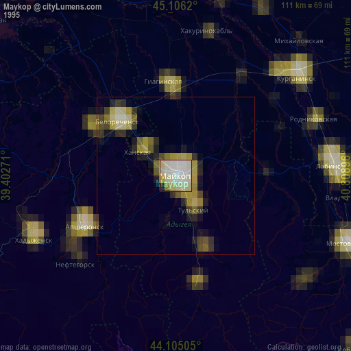
» NASA, Earths city lights 1995
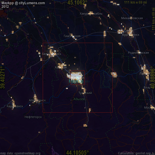
» NASA city lights 2003
» Earth at Night: Flat Maps 2012, 2016