Koshekhabl’ night lights from space
Night Light of Koshekhabl’ (Adygeya Republic) from space (Russia) Src. Average luminocity for 10x10km area is 11.6492% and for 50x50km: 2.5727%.
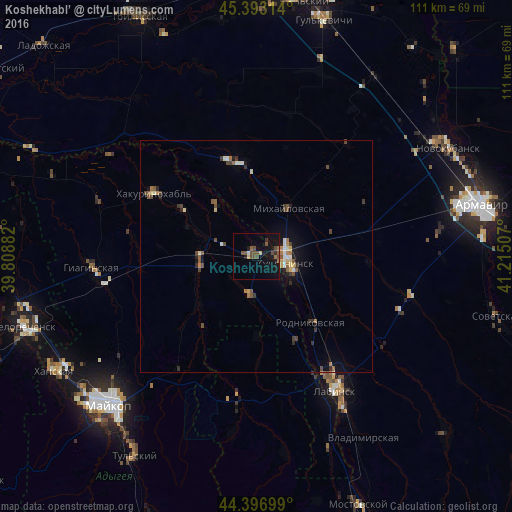
Analysis of Koshekhabl’ night lights 2016
Square area 10x10 km:
 0%
0%90-99
0.63%80-89
1.27%70-79
0%60-69
0.48%50-59
3.81%40-49
5.87%30-39
0.63%20-29
1.27%10-19
13.33%0-9
72.7%Square area 50x50 km:
0.17%90-99
0.26%80-89
0.31%70-79
0.15%60-69
0.33%50-59
0.54%40-49
0.74%30-39
0.44%20-29
0.34%10-19
1.49%0-9
95.21%Clear (daylight) street map image can be seen on geolist.org.
Map coordinates:
45° 23' 35.3" North, 39° 48' 31.8" East
44° 53' 50" North, 40° 30' 43" East
44° 23' 49.2" North, 41° 12' 54.3" East
Some cities around Koshekhabl’ sort by population:
• Labinsk
34.2 km =21.3 mi,  148°
148°
• Kurganinsk
7.1 km =4.4 mi,  105°
105°
• Rodnikovskaya
19.1 km =11.9 mi,  140°
140°
• Temirgoyevskaya
30.2 km =18.8 mi,  322°
322°
• Mikhaylovskaya
12.7 km =7.9 mi,  31°
31°
• Petropavlovskaya
21.1 km =13.1 mi,  346°
346°
• Dondukovskaya
11.9 km =7.4 mi,  261°
261°
• Yaroslavskaya
32.1 km =19.9 mi,  186°
186°
544263 (p: 7,313)
Sources (retrieved 2019-11-25):
» Earth at Night: Flat Maps 2012, 2016