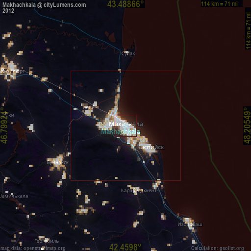
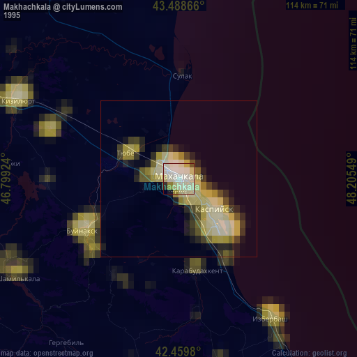
Makhachkala night lights from space
Night Light of Makhachkala (Dagestan) from space (Russia) Src. Average luminocity for 10x10km area is 65.273% and for 50x50km: 11.593%.
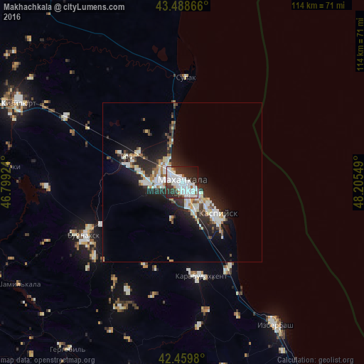

Analysis of Makhachkala night lights 2016
Square area 10x10 km:
 26.19%
90-99
24.13%80-89
1.11%70-79
1.11%60-69
0.16%50-59
3.97%40-49
1.75%30-39
14.44%20-29
17.94%10-19
7.46%0-9
1.75%Square area 50x50 km:
2.06%90-99
3.36%80-89
0.89%70-79
0.73%60-69
0.83%50-59
0.92%40-49
0.97%30-39
1.71%20-29
4.77%10-19
7.15%0-9
76.6%Clear (daylight) street map image can be seen on geolist.org.
Map coordinates:
43° 29' 19.2" North, 46° 47' 57.3" East
42° 58' 35" North, 47° 30' 8.5" East
42° 27' 35.3" North, 48° 12' 19.8" East
Some cities around Makhachkala sort by population:
• Kaspiysk
15.3 km =9.5 mi,  133°
133°
• Leninkent
12.3 km =7.6 mi,  266°
266°
• Tarki
3.6 km =2.2 mi,  189°
189°
• Shamkhal
16.3 km =10.1 mi,  304°
304°
• Novyy Khushet
9.8 km =6.1 mi,  151°
151°
• Korkmaskala
17.7 km =11 mi,  287°
287°
• Shamkhal-Termen
16.9 km =10.5 mi, 292°
• Kyakhulay
1.8 km =1.1 mi,  240°
240°
532096 (p: 497,959)
Sources (retrieved 2019-11-25):
» NASA, Earths city lights 1995
» NASA city lights 2003
» Earth at Night: Flat Maps 2012, 2016