Kutulik night lights from space
Night Light of Kutulik (Irkutsk Oblast) from space (Russia) Src. Average luminocity for 10x10km area is 1.9656% and for 50x50km: 1.4995%.
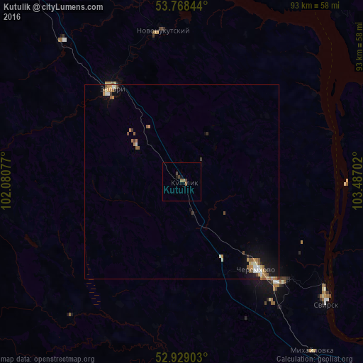
Analysis of Kutulik night lights 2016
Square area 10x10 km:
 0%
0%90-99
0%80-89
0%70-79
0%60-69
0.66%50-59
0.93%40-49
1.06%30-39
0.53%20-29
0%10-19
1.06%0-9
95.77%Square area 50x50 km:
0.11%90-99
0.23%80-89
0.18%70-79
0.24%60-69
0.27%50-59
0.32%40-49
0.18%30-39
0.17%20-29
0.07%10-19
0.97%0-9
97.26%Clear (daylight) street map image can be seen on geolist.org.
Map coordinates:
53° 46' 6.4" North, 102° 4' 50.8" East
53° 21' 2.9" North, 102° 47' 2" East
52° 55' 44.5" North, 103° 29' 13.3" East
Some cities around Kutulik sort by population:
• Cheremkhovo
28.7 km =17.8 mi,  138°
138°
• Zima
79.9 km =49.6 mi,  322°
322°
• Svirsk
46.9 km =29.1 mi,  128°
128°
• Zalari
29.5 km =18.3 mi, 321°
• Mishelevka
60.7 km =37.7 mi,  154°
154°
• Sredniy
69.8 km =43.4 mi, 137°
• Bokhan
69.3 km =43.1 mi,  108°
108°
• Tayturka
70.1 km =43.6 mi, 139°
2021116 (p: 5,390)
Sources (retrieved 2019-11-25):
» Earth at Night: Flat Maps 2012, 2016