Kratovo night lights from space
Night Light of Kratovo (Moscow Oblast) from space (Russia) Src. Average luminocity for 10x10km area is 55.2193% and for 50x50km: 34.0313%.
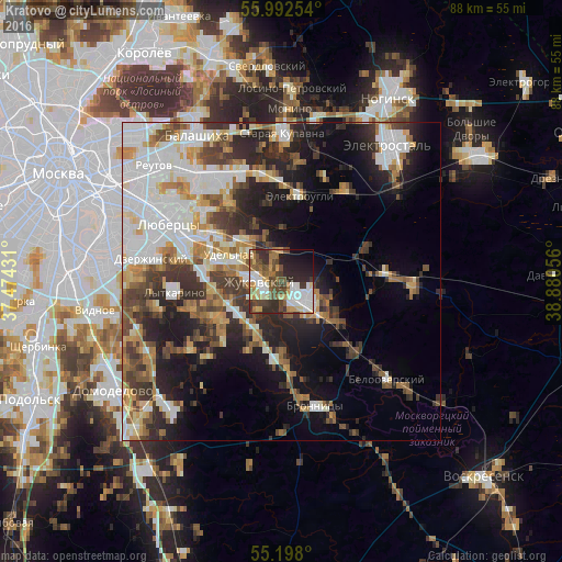
Analysis of Kratovo night lights 2016
Square area 10x10 km:
 11.65%
90-99
10.9%80-89
5.64%70-79
7.27%60-69
8.15%50-59
7.14%40-49
12.41%30-39
7.14%20-29
15.54%10-19
11.28%0-9
2.88%Square area 50x50 km:
8.5%90-99
6.91%80-89
3.08%70-79
3.69%60-69
4.25%50-59
3.8%40-49
4.77%30-39
5.48%20-29
8.33%10-19
11.58%0-9
39.61%Clear (daylight) street map image can be seen on geolist.org.
Map coordinates:
55° 59' 33.1" North, 37° 28' 27.5" East
55° 35' 50.2" North, 38° 10' 38.7" East
55° 11' 52.8" North, 38° 52' 50" East
Some cities around Kratovo sort by population:
• Zhukovskiy
3.6 km =2.2 mi,  266°
266°
• Ramenskoye
4.7 km =2.9 mi,  135°
135°
• Malakhovka
11.1 km =6.9 mi,  300°
300°
• Udel’naya
11.4 km =7.1 mi,  285°
285°
• Kraskovo
13.3 km =8.3 mi, 296°
• Oktyabr’skiy
12.6 km =7.8 mi,  275°
275°
• Bykovo
7.5 km =4.7 mi,  305°
305°
• Il’inskiy
4.4 km =2.7 mi, 303°
541286 (p: 6,799)
Sources (retrieved 2019-11-25):
» Earth at Night: Flat Maps 2012, 2016