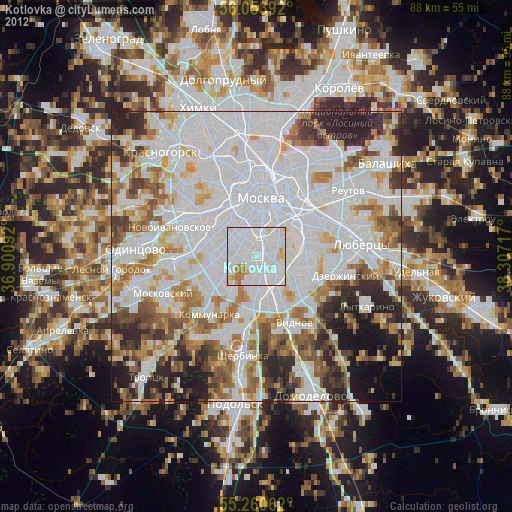
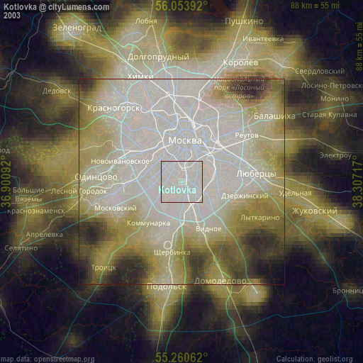
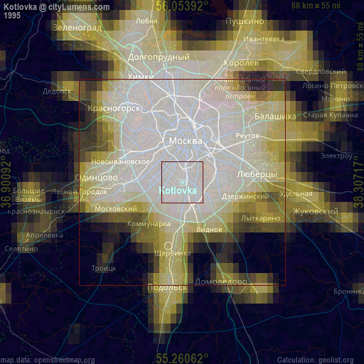
Kotlovka night lights from space
Night Light of Kotlovka (Moscow) from space (Russia) Src. Average luminocity for 10x10km area is 98.067% and for 50x50km: 80.0543%.
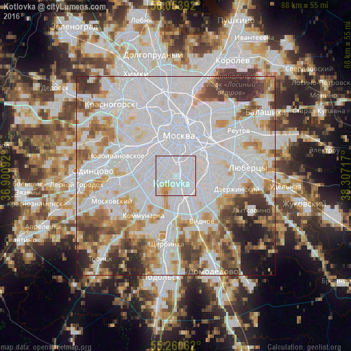
Analysis of Kotlovka night lights 2016
Square area 10x10 km:
 76.32%
90-99
16.51%80-89
3.11%70-79
3.11%60-69
0.96%50-59
0%40-49
0%30-39
0%20-29
0%10-19
0%0-9
0%Square area 50x50 km:
40.26%90-99
18.02%80-89
5.58%70-79
7.05%60-69
6.47%50-59
4.86%40-49
4.71%30-39
5.61%20-29
4.3%10-19
2.62%0-9
0.54%Clear (daylight) street map image can be seen on geolist.org.
Map coordinates:
56° 3' 14.1" North, 36° 54' 3.3" East
55° 39' 33.4" North, 37° 36' 14.5" East
55° 15' 38.2" North, 38° 18' 25.8" East
Some cities around Kotlovka sort by population:
• Tsaritsyno
4.8 km =3 mi,  142°
142°
• Zyuzino
2.3 km =1.4 mi,  260°
260°
• Cherëmushki
2.7 km =1.7 mi,  282°
282°
• Novyye Cherëmushki
4.7 km =2.9 mi,  343°
343°
• Nagornyy
1.3 km =0.8 mi, 142°
• Semënovskoye
4.3 km =2.7 mi,  308°
308°
• Leninskiye Gory
5.1 km =3.2 mi,  332°
332°
• Kolomenskoye
5 km =3.1 mi,  80°
80°
506043 (p: 64,000)
Sources (retrieved 2019-11-25):
» NASA, Earths city lights 1995
» NASA city lights 2003
» Earth at Night: Flat Maps 2012, 2016