Kamenka night lights from space
Night Light of Kamenka (Voronezj) from space (Russia) Src. Average luminocity for 10x10km area is 0% and for 50x50km: 0.0444%.
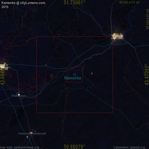
Analysis of Kamenka night lights 2016
Square area 10x10 km:
 0%
0%90-99
0%80-89
0%70-79
0%60-69
0%50-59
0%40-49
0%30-39
0%20-29
0%10-19
0%0-9
100%Square area 50x50 km:
0%90-99
0%80-89
0%70-79
0%60-69
0%50-59
0.02%40-49
0%30-39
0%20-29
0.02%10-19
0.02%0-9
99.93%Clear (daylight) street map image can be seen on geolist.org.
Map coordinates:
51° 45' 34.6" North, 42° 3' 52.8" East
51° 19' 20.3" North, 42° 46' 4.1" East
50° 52' 50.8" North, 43° 28' 15.3" East
Some cities around Kamenka sort by population:
• Balashov
37.5 km =23.3 mi,  47°
47°
• Borisoglebsk
47.7 km =29.6 mi,  275°
275°
• Povorino
39 km =24.2 mi,  248°
248°
• Gribanovskiy
56.9 km =35.4 mi,  285°
285°
• Novonikolayevskiy
47.9 km =29.8 mi,  215°
215°
• Samoylovka
67.2 km =41.8 mi,  103°
103°
• Muchkapskiy
62.3 km =38.7 mi,  340°
340°
• Romanovka
46.9 km =29.1 mi,  358°
358°
553766 (p: 9,450)
Sources (retrieved 2019-11-25):
» Earth at Night: Flat Maps 2012, 2016