Il’skiy night lights from space
Night Light of Il’skiy (Krasnodarskiy) from space (Russia) Src. Average luminocity for 10x10km area is 19.1778% and for 50x50km: 5.3037%.
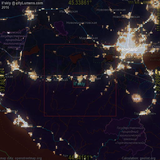
Analysis of Il’skiy night lights 2016
Square area 10x10 km:
 0.32%
0.32%90-99
1.75%80-89
1.9%70-79
4.6%60-69
4.44%50-59
2.38%40-49
4.13%30-39
0.95%20-29
2.86%10-19
14.13%0-9
62.54%Square area 50x50 km:
0.28%90-99
0.73%80-89
0.45%70-79
0.71%60-69
0.73%50-59
0.83%40-49
1.15%30-39
0.57%20-29
1%10-19
4.75%0-9
88.8%Clear (daylight) street map image can be seen on geolist.org.
Map coordinates:
45° 20' 19" North, 37° 51' 49.5" East
44° 50' 32" North, 38° 34' 0.7" East
44° 20' 29.4" North, 39° 16' 12" East
Some cities around Il’skiy sort by population:
• Severskaya
8.8 km =5.5 mi,  81°
81°
• Akhtyrskiy
20.8 km =12.9 mi,  273°
273°
• Afipskiy
22.7 km =14.1 mi,  73°
73°
• Enem
28.3 km =17.6 mi, 70°
• Kholmskiy
14.3 km =8.9 mi, 272°
• Chernomorskiy
5.8 km =3.6 mi,  279°
279°
• Smolenskaya
19.7 km =12.2 mi,  108°
108°
• Novodmitriyevskaya
24.6 km =15.3 mi,  92°
92°
556951 (p: 22,970)
Sources (retrieved 2019-11-25):
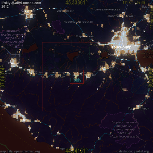
» Earth at Night: Flat Maps 2012, 2016