Gudermes night lights from space
Night Light of Gudermes (Chechnya) from space (Russia) Src. Average luminocity for 10x10km area is 42.6603% and for 50x50km: 14.4648%.
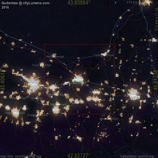
Analysis of Gudermes night lights 2016
Square area 10x10 km:
 8.73%
8.73%90-99
12.7%80-89
4.44%70-79
2.38%60-69
3.02%50-59
3.33%40-49
4.92%30-39
2.7%20-29
14.76%10-19
38.89%0-9
4.13%Square area 50x50 km:
1.55%90-99
2.44%80-89
1.5%70-79
1.44%60-69
1.59%50-59
1.89%40-49
1.74%30-39
1.52%20-29
3.95%10-19
18.59%0-9
63.79%Clear (daylight) street map image can be seen on geolist.org.
Map coordinates:
43° 51' 35.4" North, 45° 24' 22.1" East
43° 21' 2.6" North, 46° 6' 33.3" East
42° 50' 14.2" North, 46° 48' 44.6" East
Some cities around Gudermes sort by population:
• Argun
19.9 km =12.4 mi,  252°
252°
• Kurchaloy
16.6 km =10.3 mi,  185°
185°
• Tsotsin-Yurt
15 km =9.3 mi,  216°
216°
• Bachi-Yurt
15.7 km =9.8 mi,  153°
153°
• Oyskhara
14.8 km =9.2 mi,  130°
130°
• Mesker-Yurt
19.7 km =12.2 mi,  235°
235°
• Mayrtup
16.5 km =10.3 mi,  173°
173°
• Dzhalka
10.4 km =6.5 mi, 250°
558118 (p: 32,769)
Sources (retrieved 2019-11-25):
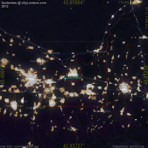
» Earth at Night: Flat Maps 2012, 2016