Kurchaloy night lights from space
Night Light of Kurchaloy (Chechnya) from space (Russia) Src. Average luminocity for 10x10km area is 30.0909% and for 50x50km: 15.2158%.
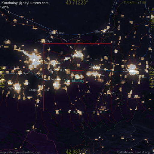
Analysis of Kurchaloy night lights 2016
Square area 10x10 km:
 3.94%
3.94%90-99
5.61%80-89
4.24%70-79
3.18%60-69
1.82%50-59
3.33%40-49
3.18%30-39
3.48%20-29
2.58%10-19
56.06%0-9
12.58%Square area 50x50 km:
1.55%90-99
2.4%80-89
1.59%70-79
1.4%60-69
1.72%50-59
1.96%40-49
2%30-39
1.85%20-29
4.26%10-19
20.46%0-9
60.82%Clear (daylight) street map image can be seen on geolist.org.
Map coordinates:
43° 42' 44" North, 45° 23' 5.9" East
43° 12' 6.6" North, 46° 5' 17.2" East
42° 41' 13.7" North, 46° 47' 28.4" East
Some cities around Kurchaloy sort by population:
• Avtury
8.2 km =5.1 mi,  238°
238°
• Tsotsin-Yurt
8.4 km =5.2 mi,  302°
302°
• Bachi-Yurt
9 km =5.6 mi,  73°
73°
• Oyskhara
14.7 km =9.1 mi,  61°
61°
• Mesker-Yurt
15.7 km =9.8 mi,  290°
290°
• Mayrtup
3.6 km =2.2 mi,  87°
87°
• Germenchuk
13.7 km =8.5 mi,  262°
262°
• Dzhalka
15.3 km =9.5 mi,  327°
327°
538913 (p: 20,903)
Sources (retrieved 2019-11-25):
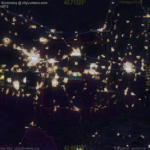
» Earth at Night: Flat Maps 2012, 2016