Grigoropolisskaya night lights from space
Night Light of Grigoropolisskaya (Stavropol’ Kray) from space (Russia) Src. Average luminocity for 10x10km area is 2.173% and for 50x50km: 1.447%.
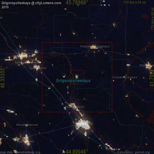
Analysis of Grigoropolisskaya night lights 2016
Square area 10x10 km:
 0%
0%90-99
0%80-89
0%70-79
0.63%60-69
0.63%50-59
0%40-49
1.11%30-39
1.27%20-29
0.48%10-19
0.79%0-9
95.08%Square area 50x50 km:
0.04%90-99
0.11%80-89
0.16%70-79
0.17%60-69
0.25%50-59
0.3%40-49
0.4%30-39
0.3%20-29
0.34%10-19
0.46%0-9
97.48%Clear (daylight) street map image can be seen on geolist.org.
Map coordinates:
45° 47' 22.8" North, 40° 21' 12.8" East
45° 17' 50" North, 41° 3' 24" East
44° 48' 1.7" North, 41° 45' 35.3" East
Some cities around Grigoropolisskaya sort by population:
• Novokubansk
20.2 km =12.6 mi,  186°
186°
• Gul’kevichi
29 km =18 mi,  282°
282°
• Novoaleksandrovsk
25.4 km =15.8 mi,  30°
30°
• Kavkazskaya
34 km =21.1 mi,  299°
299°
• Staraya Stanitsa
32.8 km =20.4 mi,  166°
166°
• Girey
33.2 km =20.6 mi,  290°
290°
• Temizhbekskaya
23.4 km =14.5 mi,  314°
314°
• Rasshevatskaya
30.9 km =19.2 mi,  356°
356°
558707 (p: 9,310)
Sources (retrieved 2019-11-25):
» Earth at Night: Flat Maps 2012, 2016