Fryanovo night lights from space
Night Light of Fryanovo (Moscow Oblast) from space (Russia) Src. Average luminocity for 10x10km area is 1.9844% and for 50x50km: 4.6213%.
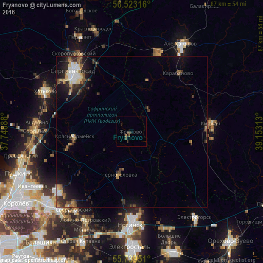
Analysis of Fryanovo night lights 2016
Square area 10x10 km:
 0%
0%90-99
0%80-89
0%70-79
0.12%60-69
0.36%50-59
0.36%40-49
1.2%30-39
1.32%20-29
0.48%10-19
0.96%0-9
95.22%Square area 50x50 km:
0.61%90-99
0.55%80-89
0.51%70-79
0.44%60-69
0.48%50-59
0.73%40-49
0.67%30-39
1%20-29
1.65%10-19
3.33%0-9
90.03%Clear (daylight) street map image can be seen on geolist.org.
Map coordinates:
56° 31' 23.4" North, 37° 44' 48.8" East
56° 7' 60" North, 38° 27' 0" East
55° 44' 22.2" North, 39° 9' 11.3" East
Some cities around Fryanovo sort by population:
• Sergiyev Posad
27 km =16.8 mi,  313°
313°
• Kirzhach
25.2 km =15.7 mi,  85°
85°
• Krasnoarmeysk
20 km =12.4 mi,  259°
259°
• Chernogolovka
15.7 km =9.8 mi,  199°
199°
• Karabanovo
25.6 km =15.9 mi,  37°
37°
• Noginsk-9
8 km =5 mi,  157°
157°
• Krasnyy Oktyabr’
26.9 km =16.7 mi, 93°
• Stromyn’
10.2 km =6.3 mi,  168°
168°
562322 (p: 11,088)
Sources (retrieved 2019-11-25):
» Earth at Night: Flat Maps 2012, 2016