Bogorodskoye night lights from space
Night Light of Bogorodskoye (Moscow Oblast) from space (Russia) Src. Average luminocity for 10x10km area is 0% and for 50x50km: 3.5181%.
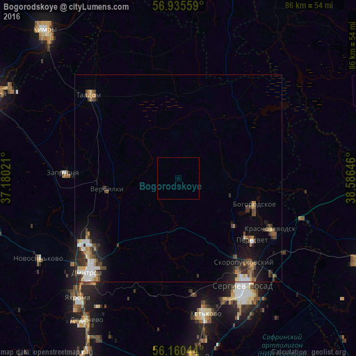
Analysis of Bogorodskoye night lights 2016
Square area 10x10 km:
 0%
0%90-99
0%80-89
0%70-79
0%60-69
0%50-59
0%40-49
0%30-39
0%20-29
0%10-19
0%0-9
100%Square area 50x50 km:
0.51%90-99
0.51%80-89
0.31%70-79
0.34%60-69
0.44%50-59
0.51%40-49
0.67%30-39
0.74%20-29
0.99%10-19
2.24%0-9
92.73%Clear (daylight) street map image can be seen on geolist.org.
Map coordinates:
56° 56' 8.1" North, 37° 10' 48.8" East
56° 33' 0" North, 37° 52' 60" East
56° 9' 37.6" North, 38° 35' 11.3" East
Some cities around Bogorodskoye sort by population:
• Sergiyev Posad
31.8 km =19.8 mi,  151°
151°
• Dmitrov
31.9 km =19.8 mi,  224°
224°
• Peresvet
22.9 km =14.2 mi,  128°
128°
• Taldom
29.6 km =18.4 mi,  313°
313°
• Zaprudnya
27.6 km =17.1 mi,  273°
273°
• Krasnozavodsk
23.3 km =14.5 mi,  118°
118°
• Verbilki
17.5 km =10.9 mi,  263°
263°
• Skoropuskovskiy
26.8 km =16.7 mi,  139°
139°
575521 (p: 9,275)
Sources (retrieved 2019-11-25):
» Earth at Night: Flat Maps 2012, 2016