Bačka Palanka night lights from space
Night Light of Bačka Palanka (Vojvodina) from space (Serbia) Src. Average luminocity for 10x10km area is 23.497% and for 50x50km: 5.2563%.
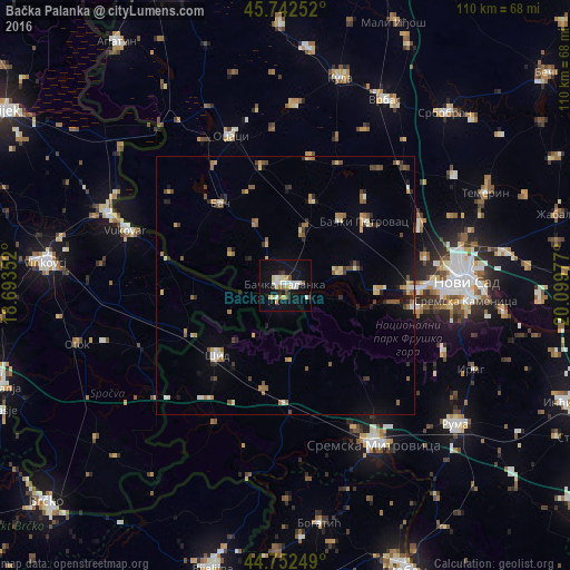
Analysis of Bačka Palanka night lights 2016
Square area 10x10 km:
 3.18%
3.18%90-99
5.91%80-89
3.18%70-79
2.88%60-69
2.27%50-59
1.36%40-49
0.91%30-39
1.21%20-29
1.52%10-19
26.21%0-9
51.36%Square area 50x50 km:
0.38%90-99
0.57%80-89
0.67%70-79
0.72%60-69
0.79%50-59
0.91%40-49
0.72%30-39
0.47%20-29
0.85%10-19
2.45%0-9
91.48%Clear (daylight) street map image can be seen on geolist.org.
Map coordinates:
45° 44' 33.1" North, 18° 41' 36.7" East
45° 14' 58.8" North, 19° 23' 47.9" East
44° 45' 9" North, 20° 5' 59.2" East
Some cities around Bačka Palanka sort by population:
• Novi Sad
34.5 km =21.4 mi,  89°
89°
• Sremska Mitrovica
34.8 km =21.6 mi,  150°
150°
• Vukovar, HR
32.9 km =20.4 mi,  290°
290°
• Veternik
28.4 km =17.6 mi, 88°
• Bački Petrovac
19.6 km =12.2 mi,  51°
51°
• Ilok, HR
3.4 km =2.1 mi,  206°
206°
• Borovo, HR
36.4 km =22.6 mi, 292°
• Čelarevo
10.3 km =6.4 mi,  77°
77°
3204674 (p: 29,449)
Sources (retrieved 2019-11-25):
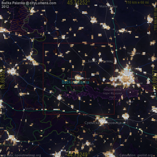
» Earth at Night: Flat Maps 2012, 2016