Voineşti night lights from space
Night Light of Voineşti (Iaşi) from space (Romania) Src. Average luminocity for 10x10km area is 0.321% and for 50x50km: 3.6062%.
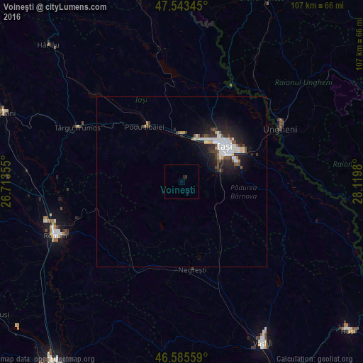
Analysis of Voineşti night lights 2016
Square area 10x10 km:
100  0%
0%
90-99 0%
80-89 0%
70-79 0%
60-69 0%
50-59 0%
40-49 0%
30-39 0.14%
20-29 0.85%
10-19 0.14%
0-9 98.86%
0%90-99
0%80-89
0%70-79
0%60-69
0%50-59
0%40-49
0%30-39
0.14%20-29
0.85%10-19
0.14%0-9
98.86%Square area 50x50 km:
100 1.02%
90-99 0.64%
80-89 0.14%
70-79 0.26%
60-69 0.21%
50-59 0.3%
40-49 0.51%
30-39 0.44%
20-29 1.29%
10-19 2.74%
0-9 92.46%
1.02%90-99
0.64%80-89
0.14%70-79
0.26%60-69
0.21%50-59
0.3%40-49
0.51%30-39
0.44%20-29
1.29%10-19
2.74%0-9
92.46%Clear (daylight) street map image can be seen on geolist.org.
Map coordinates:
47° 32' 36.4" North, 26° 42' 48.8" East
47° 4' 0" North, 27° 25' 0" East
46° 35' 8.1" North, 28° 7' 11.3" East
Some cities around Voineşti sort by population:
• Iaşi
17.8 km =11.1 mi,  51°
51°
• Ciurea
11.5 km =7.1 mi,  99°
99°
• Podu Iloaiei
20.2 km =12.6 mi,  325°
325°
• Miroslava
12 km =7.5 mi,  39°
39°
• Ţibăneşti
17.8 km =11.1 mi,  200°
200°
• Ţibana
11.2 km =7 mi,  214°
214°
• Leţcani
13 km =8.1 mi,  0°
0°
• Rediu
17.8 km =11.1 mi,  20°
20°
662516 (p: 6,161)
Sources (retrieved 2019-11-25):
» Earth at Night: Flat Maps 2012, 2016