Sector 1 night lights from space
Night Light of Sector 1 (Bucureşti) from space (Romania) Src. Average luminocity for 10x10km area is 90.1429% and for 50x50km: 27.4348%.
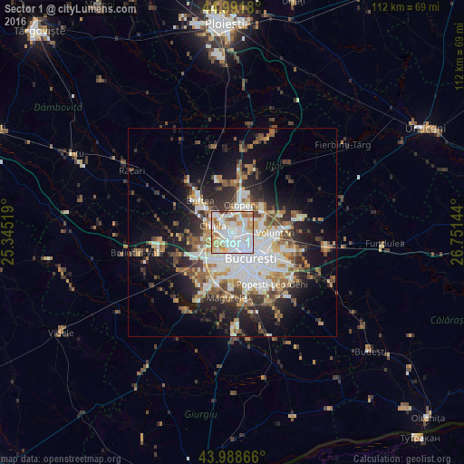
Analysis of Sector 1 night lights 2016
Square area 10x10 km:
 38.73%
90-99
28.41%80-89
11.43%70-79
7.78%60-69
10.79%50-59
1.9%40-49
0.79%30-39
0.16%20-29
0%10-19
0%0-9
0%Square area 50x50 km:
6.49%90-99
5.76%80-89
2.58%70-79
2.92%60-69
3.41%50-59
3.2%40-49
3.96%30-39
3.33%20-29
6.53%10-19
11.53%0-9
50.28%Clear (daylight) street map image can be seen on geolist.org.
Map coordinates:
44° 59' 30.5" North, 25° 20' 42.7" East
44° 29' 32.6" North, 26° 2' 53.9" East
43° 59' 19.2" North, 26° 45' 5.2" East
Some cities around Sector 1 sort by population:
• Bucharest
8.1 km =5 mi,  145°
145°
• Voluntari
9.9 km =6.2 mi,  91°
91°
• Buftea
11 km =6.8 mi,  314°
314°
• Chitila
5.5 km =3.4 mi,  288°
288°
• Otopeni
6.6 km =4.1 mi,  12°
12°
• Chiajna
7 km =4.3 mi,  238°
238°
• Dobroeşti
11.7 km =7.3 mi,  113°
113°
• Mogoşoaia
5.6 km =3.5 mi,  316°
316°
11048317 (p: 225,453)
Sources (retrieved 2019-11-25):
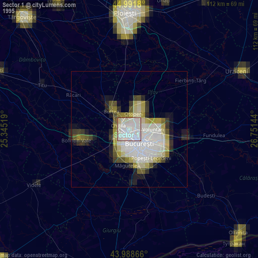
» NASA, Earths city lights 1995
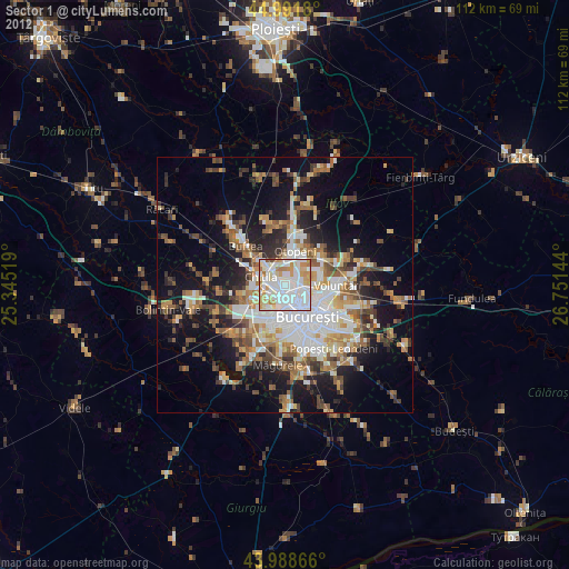
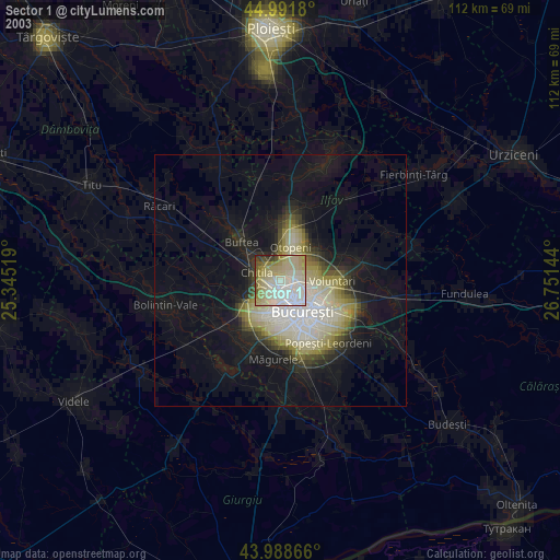
» NASA city lights 2003
» Earth at Night: Flat Maps 2012, 2016