Popeşti night lights from space
Night Light of Popeşti (Bihor) from space (Romania) Src. Average luminocity for 10x10km area is 0.1771% and for 50x50km: 0.6722%.
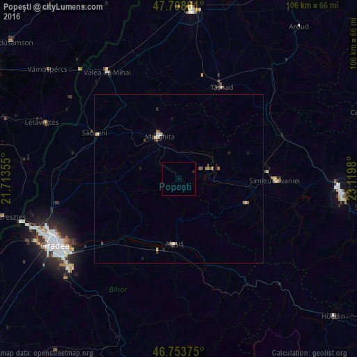
Analysis of Popeşti night lights 2016
Square area 10x10 km:
 0%
0%90-99
0%80-89
0%70-79
0%60-69
0%50-59
0%40-49
0%30-39
0%20-29
0.6%10-19
0%0-9
99.4%Square area 50x50 km:
0.05%90-99
0.09%80-89
0.08%70-79
0.08%60-69
0.16%50-59
0.11%40-49
0.11%30-39
0.06%20-29
0.19%10-19
0.22%0-9
98.86%Clear (daylight) street map image can be seen on geolist.org.
Map coordinates:
47° 42' 31" North, 21° 42' 48.8" East
47° 13' 60" North, 22° 25' 0" East
46° 45' 13.5" North, 23° 7' 11.3" East
Some cities around Popeşti sort by population:
• Şimleu Silvaniei
28.9 km =18 mi,  90°
90°
• Marghita
14.4 km =8.9 mi,  334°
334°
• Aleşd
18.5 km =11.5 mi,  180°
180°
• Tăşnad
30.5 km =19 mi,  24°
24°
• Săcueni
27.2 km =16.9 mi,  298°
298°
• Tileagd
24.7 km =15.3 mi,  221°
221°
• Diosig
32.3 km =20.1 mi,  283°
283°
• Nuşfalău
24.2 km =15 mi,  98°
98°
669882 (p: 8,386)
Sources (retrieved 2019-11-25):
» Earth at Night: Flat Maps 2012, 2016