Negreşti night lights from space
Night Light of Negreşti (Vaslui) from space (Romania) Src. Average luminocity for 10x10km area is 0.2649% and for 50x50km: 0.612%.
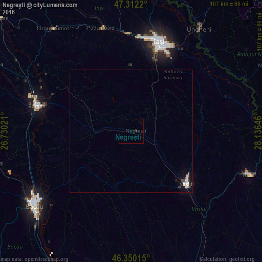
Analysis of Negreşti night lights 2016
Square area 10x10 km:
 0%
0%90-99
0%80-89
0%70-79
0%60-69
0%50-59
0%40-49
0%30-39
0.6%20-29
0%10-19
0%0-9
99.4%Square area 50x50 km:
0.15%90-99
0.16%80-89
0%70-79
0.09%60-69
0.01%50-59
0.02%40-49
0.09%30-39
0.12%20-29
0.01%10-19
0.37%0-9
98.99%Clear (daylight) street map image can be seen on geolist.org.
Map coordinates:
47° 18' 43.9" North, 26° 43' 48.8" East
46° 49' 60" North, 27° 25' 60" East
46° 21' 0.5" North, 28° 8' 11.3" East
Some cities around Negreşti sort by population:
• Vaslui
31.9 km =19.8 mi,  134°
134°
• Ciurea
26.1 km =16.2 mi,  22°
22°
• Ţibăneşti
12 km =7.5 mi,  320°
320°
• Ţibana
18.3 km =11.4 mi,  335°
335°
• Laza
23.4 km =14.5 mi,  150°
150°
• Voineşti
26 km =16.2 mi,  357°
357°
• Todireşti
5.4 km =3.4 mi,  290°
290°
• Deleşti
17.3 km =10.7 mi, 149°
672375 (p: 10,043)
Sources (retrieved 2019-11-25):
» Earth at Night: Flat Maps 2012, 2016