Maglavit night lights from space
Night Light of Maglavit (Dolj) from space (Romania) Src. Average luminocity for 10x10km area is 0.0492% and for 50x50km: 2.5394%.
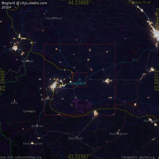
Analysis of Maglavit night lights 2016
Square area 10x10 km:
 0%
0%90-99
0%80-89
0%70-79
0%60-69
0%50-59
0%40-49
0%30-39
0%20-29
0%10-19
0%0-9
100%Square area 50x50 km:
0.28%90-99
0.26%80-89
0.2%70-79
0.21%60-69
0.39%50-59
0.4%40-49
0.67%30-39
0.37%20-29
0.56%10-19
1.74%0-9
94.92%Clear (daylight) street map image can be seen on geolist.org.
Map coordinates:
44° 32' 12" North, 22° 23' 48.8" East
44° 1' 60" North, 23° 6' 0" East
43° 31' 32.4" North, 23° 48' 11.3" East
Some cities around Maglavit sort by population:
• Vidin, BG
18 km =11.2 mi,  255°
255°
• Băileşti
20.1 km =12.5 mi,  95°
95°
• Calafat
14.2 km =8.8 mi,  250°
250°
• Poiana Mare
13.2 km =8.2 mi,  191°
191°
• Moţăţei
9.7 km =6 mi,  55°
55°
• Ciupercenii Noi
18.3 km =11.4 mi,  221°
221°
• Cetate
8.4 km =5.2 mi,  331°
331°
• Piscu Vechi
15.8 km =9.8 mi,  160°
160°
674170 (p: 5,753)
Sources (retrieved 2019-11-25):
» Earth at Night: Flat Maps 2012, 2016