Gura Văii night lights from space
Night Light of Gura Văii (Bacău) from space (Romania) Src. Average luminocity for 10x10km area is 0.5446% and for 50x50km: 2.1652%.
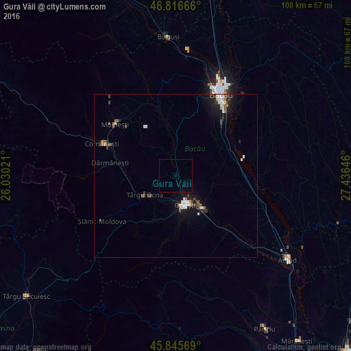
Analysis of Gura Văii night lights 2016
Square area 10x10 km:
 0%
0%90-99
0%80-89
0%70-79
0%60-69
0%50-59
0%40-49
0%30-39
0%20-29
0%10-19
0%0-9
100%Square area 50x50 km:
0.28%90-99
0.4%80-89
0.24%70-79
0.1%60-69
0.16%50-59
0.25%40-49
0.41%30-39
0.36%20-29
0.46%10-19
1.76%0-9
95.58%Clear (daylight) street map image can be seen on geolist.org.
Map coordinates:
46° 48' 60" North, 26° 1' 48.8" East
46° 19' 60" North, 26° 43' 60" East
45° 50' 44.5" North, 27° 26' 11.3" East
Some cities around Gura Văii sort by population:
• Târgu Ocna
11 km =6.8 mi,  236°
236°
• Dofteana
16.7 km =10.4 mi,  263°
263°
• Helegiu
2.3 km =1.4 mi,  34°
34°
• Cleja
15.8 km =9.8 mi,  54°
54°
• Bereşti-Tazlău
15.7 km =9.8 mi,  340°
340°
• Târgu Trotuş
9 km =5.6 mi,  214°
214°
• Berzunţi
10.7 km =6.6 mi,  314°
314°
• Livezi-Vale
9.3 km =5.8 mi,  0°
0°
676462 (p: 6,075)
Sources (retrieved 2019-11-25):
» Earth at Night: Flat Maps 2012, 2016