Ernei night lights from space
Night Light of Ernei (Mureş) from space (Romania) Src. Average luminocity for 10x10km area is 3.9219% and for 50x50km: 2.2904%.
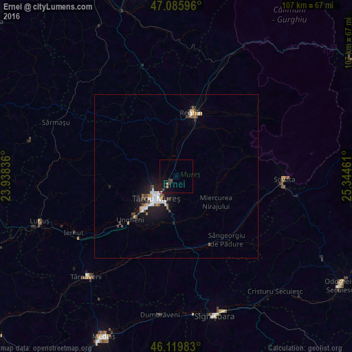
Analysis of Ernei night lights 2016
Square area 10x10 km:
 0.28%
0.28%90-99
0.14%80-89
0%70-79
0.14%60-69
0.85%50-59
0.14%40-49
1.14%30-39
1.14%20-29
0.85%10-19
6.53%0-9
88.78%Square area 50x50 km:
0.47%90-99
0.35%80-89
0.09%70-79
0.19%60-69
0.22%50-59
0.24%40-49
0.4%30-39
0.26%20-29
0.56%10-19
2.07%0-9
95.13%Clear (daylight) street map image can be seen on geolist.org.
Map coordinates:
47° 5' 9.5" North, 23° 56' 18.1" East
46° 36' 18.2" North, 24° 38' 29.3" East
46° 7' 11.4" North, 25° 20' 40.6" East
Some cities around Ernei sort by population:
• Târgu-Mureş
9.5 km =5.9 mi,  222°
222°
• Sângeorgiu de Mureş
5.3 km =3.3 mi, 222°
• Ungheni
19 km =11.8 mi, 224°
• Sâncraiu de Mureş
10.6 km =6.6 mi,  235°
235°
• Pănet
14.3 km =8.9 mi,  247°
247°
• Gorneşti
7.4 km =4.6 mi,  3°
3°
• Miercurea Nirajului
14.5 km =9 mi,  123°
123°
• Cristeşti
16.8 km =10.4 mi,  225°
225°
678535 (p: 5,141)
Sources (retrieved 2019-11-25):
» Earth at Night: Flat Maps 2012, 2016