Călugăreni night lights from space
Night Light of Călugăreni (Giurgiu) from space (Romania) Src. Average luminocity for 10x10km area is 1.7561% and for 50x50km: 7.9023%.
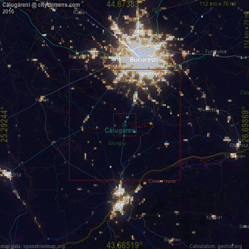
Analysis of Călugăreni night lights 2016
Square area 10x10 km:
 0%
0%90-99
0%80-89
0%70-79
0%60-69
0%50-59
0.45%40-49
1.82%30-39
1.36%20-29
0%10-19
0.3%0-9
96.06%Square area 50x50 km:
0.98%90-99
1.28%80-89
0.72%70-79
0.93%60-69
1.04%50-59
1.46%40-49
1.7%30-39
1.32%20-29
2.61%10-19
4.21%0-9
83.75%Clear (daylight) street map image can be seen on geolist.org.
Map coordinates:
44° 40' 25.8" North, 25° 17' 32.8" East
44° 10' 18" North, 25° 59' 44" East
43° 39' 54.7" North, 26° 41' 55.3" East
Some cities around Călugăreni sort by population:
• Jilava
19.1 km =11.9 mi,  20°
20°
• Măgurele
20.1 km =12.5 mi,  8°
8°
• Vidra
17 km =10.6 mi,  54°
54°
• 1 Decembrie
14.2 km =8.8 mi, 20°
• Comana
11.9 km =7.4 mi,  90°
90°
• Mihăileşti
18.6 km =11.6 mi,  338°
338°
• Băneasa
15 km =9.3 mi,  158°
158°
• Cornetu
19.4 km =12.1 mi,  347°
347°
682912 (p: 6,444)
Sources (retrieved 2019-11-25):
» Earth at Night: Flat Maps 2012, 2016