Călimăneşti night lights from space
Night Light of Călimăneşti (Vâlcea) from space (Romania) Src. Average luminocity for 10x10km area is 0.5848% and for 50x50km: 1.7699%.
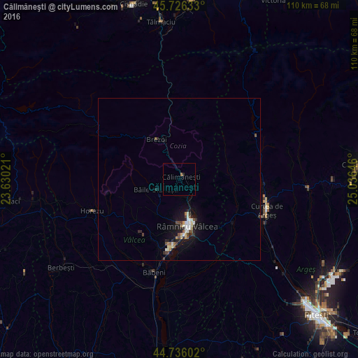
Analysis of Călimăneşti night lights 2016
Square area 10x10 km:
 0%
0%90-99
0%80-89
0%70-79
0%60-69
0.61%50-59
0%40-49
0%30-39
0%20-29
0.61%10-19
0%0-9
98.79%Square area 50x50 km:
0.19%90-99
0.34%80-89
0.19%70-79
0.07%60-69
0.17%50-59
0.2%40-49
0.29%30-39
0.23%20-29
0.41%10-19
1.79%0-9
96.1%Clear (daylight) street map image can be seen on geolist.org.
Map coordinates:
45° 43' 34.8" North, 23° 37' 48.8" East
45° 13' 60" North, 24° 19' 60" East
44° 44' 9.7" North, 25° 2' 11.3" East
Some cities around Călimăneşti sort by population:
• Râmnicu Vâlcea
15.1 km =9.4 mi,  170°
170°
• Curtea de Argeş
28.9 km =18 mi,  112°
112°
• Horezu
26.5 km =16.5 mi,  249°
249°
• Brezoi
13.4 km =8.3 mi,  330°
330°
• Mihăeşti
23.2 km =14.4 mi,  196°
196°
• Albeştii Pământeni
26.2 km =16.3 mi,  94°
94°
• Corbeni
25.9 km =16.1 mi,  73°
73°
• Budeşti
20.8 km =12.9 mi, 169°
682972 (p: 8,485)
Sources (retrieved 2019-11-25):
» Earth at Night: Flat Maps 2012, 2016