Bălţăteşti night lights from space
Night Light of Bălţăteşti (Neamţ) from space (Romania) Src. Average luminocity for 10x10km area is 0% and for 50x50km: 1.3888%.
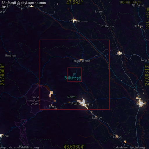
Analysis of Bălţăteşti night lights 2016
Square area 10x10 km:
 0%
0%90-99
0%80-89
0%70-79
0%60-69
0%50-59
0%40-49
0%30-39
0%20-29
0%10-19
0%0-9
100%Square area 50x50 km:
0.16%90-99
0.33%80-89
0.11%70-79
0.24%60-69
0.04%50-59
0.13%40-49
0.18%30-39
0.26%20-29
0.09%10-19
0.98%0-9
97.48%Clear (daylight) street map image can be seen on geolist.org.
Map coordinates:
47° 35' 34.8" North, 25° 35' 48.8" East
47° 7' 0" North, 26° 18' 0" East
46° 38' 9.7" North, 27° 0' 11.3" East
Some cities around Bălţăteşti sort by population:
• Târgu Neamţ
10.5 km =6.5 mi,  28°
28°
• Vânători-Neamţ
9.4 km =5.8 mi,  7°
7°
• Răuceşti
17.2 km =10.7 mi, 30°
• Petricani
13.8 km =8.6 mi,  66°
66°
• Brusturi
19.6 km =12.2 mi,  18°
18°
• Grumăzeşti
5.4 km =3.4 mi, 69°
• Bodeşti
12.8 km =8 mi,  136°
136°
• Viişoara
21 km =13 mi,  193°
193°
685551 (p: 6,635)
Sources (retrieved 2019-11-25):
» Earth at Night: Flat Maps 2012, 2016