Aves night lights from space
Night Light of Aves (Porto) from space (Portugal) Src. Average luminocity for 10x10km area is 72.3912% and for 50x50km: 64.8054%.
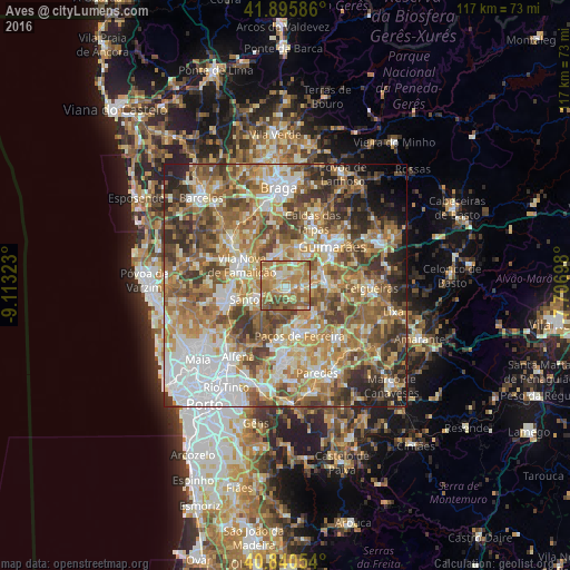
Analysis of Aves night lights 2016
Square area 10x10 km:
 3.57%
3.57%90-99
13.44%80-89
12.93%70-79
21.94%60-69
31.97%50-59
10.2%40-49
5.44%30-39
0.51%20-29
0%10-19
0%0-9
0%Square area 50x50 km:
11.65%90-99
12.97%80-89
8.68%70-79
11.2%60-69
14.43%50-59
11.99%40-49
10.1%30-39
7.84%20-29
6.36%10-19
2.87%0-9
1.9%Clear (daylight) street map image can be seen on geolist.org.
Map coordinates:
41° 53' 45.1" North, 9° 6' 47.6" West
41° 22' 13.2" North, 8° 24' 36.4" West
40° 50' 25.9" North, 7° 42' 25.1" West
Some cities around Aves sort by population:
• Santo Tirso
6.4 km =4 mi,  241°
241°
• Caldas de Vizela
8.5 km =5.3 mi,  81°
81°
• Selho
7.6 km =4.7 mi,  44°
44°
• Joane
7.6 km =4.7 mi,  1°
1°
• Negrelos
2.4 km =1.5 mi,  162°
162°
• Moreira de Conegos
6.2 km =3.9 mi,  72°
72°
• Barrosas
9.4 km =5.8 mi,  100°
100°
• São Miguel do Couto
6.1 km =3.8 mi,  225°
225°
2742577 (p: 8,507)
Sources (retrieved 2019-11-25):
» Earth at Night: Flat Maps 2012, 2016