Pińczów night lights from space
Night Light of Pińczów (Świętokrzyskie) from space (Poland) Src. Average luminocity for 10x10km area is 5.9258% and for 50x50km: 1.5898%.
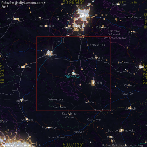
Analysis of Pińczów night lights 2016
Square area 10x10 km:
 1.96%
1.96%90-99
1.4%80-89
0%70-79
0%60-69
0%50-59
1.12%40-49
1.12%30-39
0%20-29
0.42%10-19
0.28%0-9
93.7%Square area 50x50 km:
0.23%90-99
0.26%80-89
0.12%70-79
0.18%60-69
0.22%50-59
0.24%40-49
0.26%30-39
0.14%20-29
0.11%10-19
0.33%0-9
97.9%Clear (daylight) street map image can be seen on geolist.org.
Map coordinates:
50° 57' 55.6" North, 19° 49' 24.1" East
50° 31' 13.9" North, 20° 31' 35.4" East
50° 4' 16.9" North, 21° 13' 46.6" East
Some cities around Pińczów sort by population:
• Kielce
39.5 km =24.5 mi,  10°
10°
• Busko-Zdrój
14.7 km =9.1 mi,  112°
112°
• Jędrzejów
20.5 km =12.7 mi,  310°
310°
• Staszów
45.4 km =28.2 mi,  84°
84°
• Miechów
39.7 km =24.7 mi,  242°
242°
• Sędziszów
33.7 km =20.9 mi,  278°
278°
• Proszowice
40.1 km =24.9 mi,  204°
204°
• Kazimierza Wielka
28.4 km =17.6 mi,  184°
184°
762201 (p: 11,806)
Sources (retrieved 2019-11-25):
» Earth at Night: Flat Maps 2012, 2016