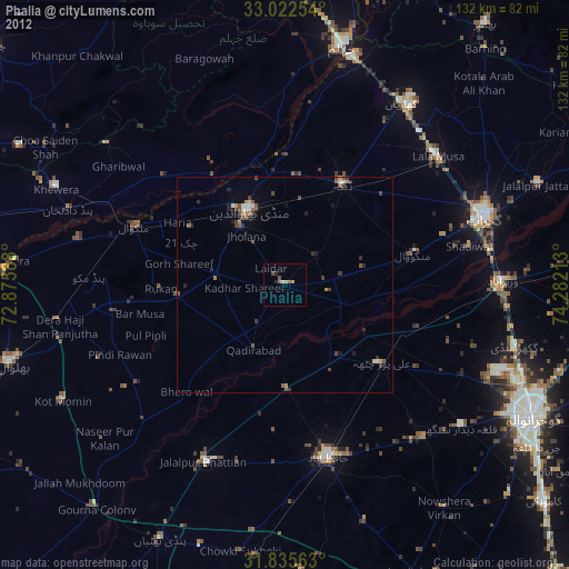
Phalia night lights from space
Night Light of Phalia (Punjab) from space (Pakistan) Src. Average luminocity for 10x10km area is 5.3278% and for 50x50km: 1.6151%.
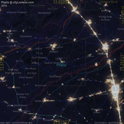
Analysis of Phalia night lights 2016
Square area 10x10 km:
 0%
0%90-99
0%80-89
0.73%70-79
0%60-69
1.1%50-59
1.83%40-49
3.66%30-39
0.55%20-29
1.1%10-19
1.28%0-9
89.74%Square area 50x50 km:
0.01%90-99
0.16%80-89
0.19%70-79
0.2%60-69
0.31%50-59
0.37%40-49
0.46%30-39
0.24%20-29
0.33%10-19
0.8%0-9
96.93%Clear (daylight) street map image can be seen on geolist.org.
Map coordinates:
33° 1' 21.1" North, 72° 52' 33.2" East
32° 25' 51.7" North, 73° 34' 44.4" East
31° 50' 8.3" North, 74° 16' 55.7" East
Some cities around Phalia sort by population:
• Hafizabad
41.3 km =25.7 mi,  165°
165°
• Mandi Bahauddin
19.2 km =11.9 mi,  334°
334°
• Lala Musa
46.5 km =28.9 mi,  49°
49°
• Dinga
26.8 km =16.7 mi,  29°
29°
• Malakwal City
37.1 km =23.1 mi,  291°
291°
• Malakwal
37 km =23 mi, 291°
• Kunjah
38.7 km =24 mi,  73°
73°
• Rasulnagar
22.1 km =13.7 mi,  121°
121°
1168166 (p: 24,789)
Sources (retrieved 2019-11-25):
» Earth at Night: Flat Maps 2012, 2016