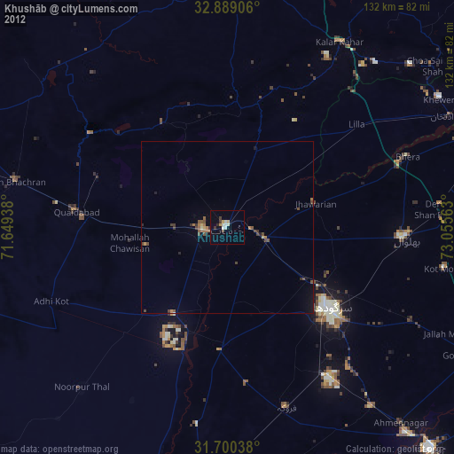
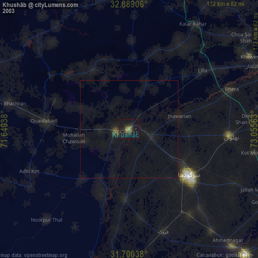
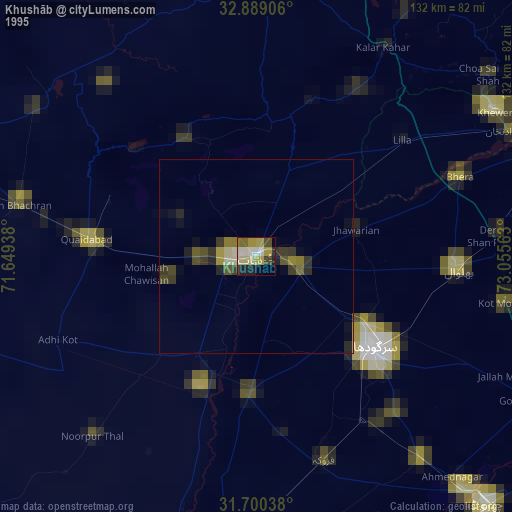
Khushāb night lights from space
Night Light of Khushāb (Punjab) from space (Pakistan) Src. Average luminocity for 10x10km area is 12.8535% and for 50x50km: 1.5767%.
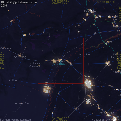
Analysis of Khushāb night lights 2016
Square area 10x10 km:
 0%
0%90-99
1.1%80-89
0.37%70-79
4.03%60-69
1.47%50-59
2.93%40-49
3.11%30-39
1.65%20-29
0.55%10-19
5.86%0-9
78.94%Square area 50x50 km:
0%90-99
0.04%80-89
0.1%70-79
0.35%60-69
0.14%50-59
0.45%40-49
0.45%30-39
0.28%20-29
0.39%10-19
0.71%0-9
97.09%Clear (daylight) street map image can be seen on geolist.org.
Map coordinates:
32° 53' 20.6" North, 71° 38' 57.8" East
32° 17' 48" North, 72° 21' 9" East
31° 42' 1.4" North, 73° 3' 20.3" East
Some cities around Khushāb sort by population:
• Sargodha
38.3 km =23.8 mi,  127°
127°
• Jauharabad
6.7 km =4.2 mi,  263°
263°
• Sahiwal
35.9 km =22.3 mi,  183°
183°
• Jhawarian
26.4 km =16.4 mi,  74°
74°
• Mitha Tiwana
23.9 km =14.9 mi, 256°
• Faruka
46 km =28.6 mi,  172°
172°
• Mangla
45 km =28 mi, 176°
• Shahpur
11.4 km =7.1 mi,  106°
106°
1173687 (p: 102,793)
Sources (retrieved 2019-11-25):
» NASA, Earths city lights 1995
» NASA city lights 2003
» Earth at Night: Flat Maps 2012, 2016