Talusan night lights from space
Night Light of Talusan (Zamboanga Peninsula) from space (Philippines) Src. Average luminocity for 10x10km area is 1.0216% and for 50x50km: 0.8839%.
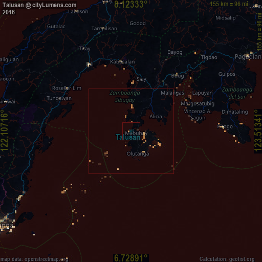
Analysis of Talusan night lights 2016
Square area 10x10 km:
 0%
0%90-99
0%80-89
0%70-79
0%60-69
0.87%50-59
0%40-49
0%30-39
0%20-29
0.87%10-19
0%0-9
98.27%Square area 50x50 km:
0%90-99
0%80-89
0.03%70-79
0.47%60-69
0.35%50-59
0.07%40-49
0.07%30-39
0.07%20-29
0.16%10-19
0.18%0-9
98.61%Clear (daylight) street map image can be seen on geolist.org.
Map coordinates:
8° 7' 24" North, 122° 6' 25.8" East
7° 25' 36" North, 122° 48' 37" East
6° 43' 44.1" North, 123° 30' 48.3" East
Some cities around Talusan sort by population:
• Ipil
46.8 km =29.1 mi,  328°
328°
• Margosatubig
42.6 km =26.5 mi,  66°
66°
• Katipunan
17.5 km =10.9 mi,  7°
7°
• Buug
43.5 km =27 mi,  39°
39°
• Malangas
33.3 km =20.7 mi,  47°
47°
• Naga
38.8 km =24.1 mi,  350°
350°
• Olutanga
13.5 km =8.4 mi,  162°
162°
• Imelda
29.1 km =18.1 mi,  32°
32°
1683701 (p: 5,783)
Sources (retrieved 2019-11-25):
» Earth at Night: Flat Maps 2012, 2016