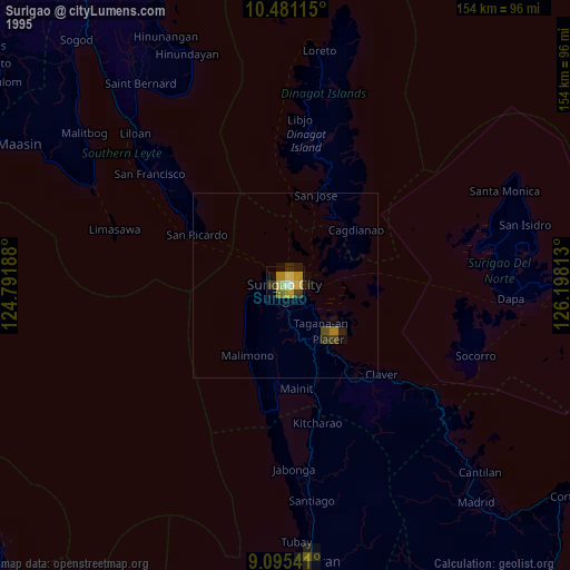
Surigao night lights from space
Night Light of Surigao (Caraga) from space (Philippines) Src. Average luminocity for 10x10km area is 8.8442% and for 50x50km: 0.4405%.
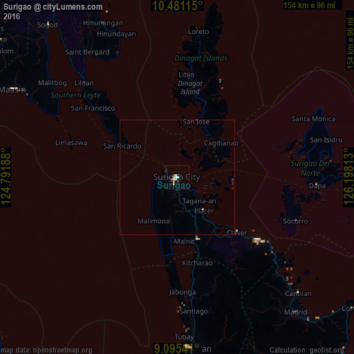
Analysis of Surigao night lights 2016
Square area 10x10 km:
 1.52%
1.52%90-99
1.08%80-89
1.73%70-79
0.87%60-69
1.08%50-59
0.87%40-49
1.52%30-39
1.3%20-29
0.87%10-19
0.43%0-9
88.74%Square area 50x50 km:
0.06%90-99
0.04%80-89
0.08%70-79
0.06%60-69
0.04%50-59
0.03%40-49
0.08%30-39
0.11%20-29
0.12%10-19
0.05%0-9
99.33%Clear (daylight) street map image can be seen on geolist.org.
Map coordinates:
10° 28' 52.1" North, 124° 47' 30.8" East
9° 47' 20.4" North, 125° 29' 42" East
9° 5' 43.5" North, 126° 11' 53.3" East
Some cities around Surigao sort by population:
• Placer
19.1 km =11.9 mi,  141°
141°
• Socorro
55 km =34.2 mi,  109°
109°
• Luna
5.8 km =3.6 mi,  177°
177°
• Kitcharao
38.1 km =23.7 mi,  167°
167°
• Claver
35.5 km =22.1 mi,  132°
132°
• Alegria
36.9 km =22.9 mi, 165°
• Mainit
28.4 km =17.6 mi, 173°
• Bacuag
25.6 km =15.9 mi, 141°
1685218 (p: 87,832)
Sources (retrieved 2019-11-25):
» NASA, Earths city lights 1995
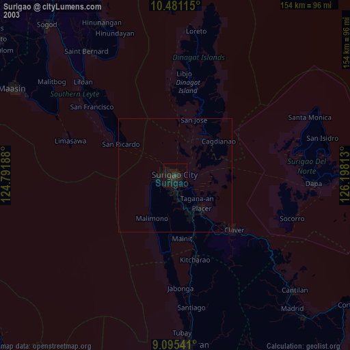
» NASA city lights 2003
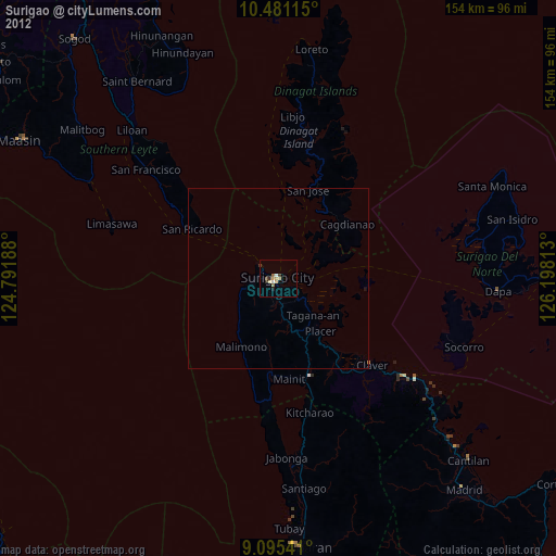
» Earth at Night: Flat Maps 2012, 2016