Ponot night lights from space
Night Light of Ponot (Zamboanga Peninsula) from space (Philippines) Src. Average luminocity for 10x10km area is 0.6074% and for 50x50km: 0.0954%.
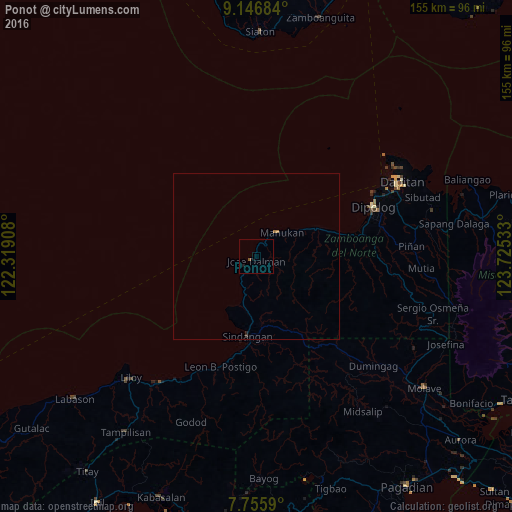
Analysis of Ponot night lights 2016
Square area 10x10 km:
 0%
0%90-99
0%80-89
0%70-79
0%60-69
0%50-59
0.83%40-49
0%30-39
0%20-29
0%10-19
0.83%0-9
98.35%Square area 50x50 km:
0%90-99
0%80-89
0%70-79
0.02%60-69
0.05%50-59
0.03%40-49
0.01%30-39
0.03%20-29
0.03%10-19
0.03%0-9
99.8%Clear (daylight) street map image can be seen on geolist.org.
Map coordinates:
9° 8' 48.6" North, 122° 19' 8.7" East
8° 27' 7.2" North, 123° 1' 19.9" East
7° 45' 21.2" North, 123° 43' 31.2" East
Some cities around Ponot sort by population:
• Dipolog
36.7 km =22.8 mi,  69°
69°
• Dapitan
49.5 km =30.8 mi,  62°
62°
• Mahayag
59.5 km =37 mi,  128°
128°
• Manukan
12.4 km =7.7 mi,  43°
43°
• Olingan
34.3 km =21.3 mi, 73°
• Salug
45.8 km =28.5 mi,  215°
215°
• Dumingag
47.9 km =29.8 mi, 131°
• Sindangan
24 km =14.9 mi,  186°
186°
1692989 (p: 6,624)
Sources (retrieved 2019-11-25):
» Earth at Night: Flat Maps 2012, 2016