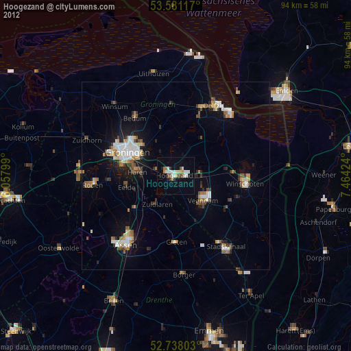
Hoogezand night lights from space
Night Light of Hoogezand (Groningen) from space (Netherlands) Src. Average luminocity for 10x10km area is 19.3864% and for 50x50km: 7.1586%.
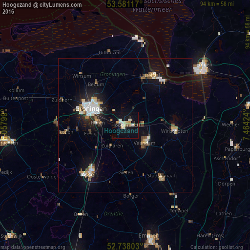
Analysis of Hoogezand night lights 2016
Square area 10x10 km:
 2.02%
2.02%90-99
3.41%80-89
4.92%70-79
1.77%60-69
1.39%50-59
1.14%40-49
0.51%30-39
1.26%20-29
1.14%10-19
19.32%0-9
63.13%Square area 50x50 km:
1.06%90-99
1.31%80-89
0.76%70-79
0.76%60-69
0.64%50-59
0.8%40-49
0.77%30-39
0.75%20-29
1.28%10-19
5.31%0-9
86.56%Clear (daylight) street map image can be seen on geolist.org.
Map coordinates:
53° 34' 52.2" North, 6° 3' 28.8" East
53° 9' 42" North, 6° 45' 40" East
52° 44' 16.9" North, 7° 27' 51.3" East
Some cities around Hoogezand sort by population:
• Groningen
14.4 km =8.9 mi,  296°
296°
• Veendam
10 km =6.2 mi,  127°
127°
• Korrewegwijk
15.1 km =9.4 mi, 301°
• Oosterpark
13.6 km =8.5 mi, 300°
• Haren
10.2 km =6.3 mi,  276°
276°
• Sappemeer
2 km =1.2 mi,  81°
81°
• Eelde
13.6 km =8.5 mi,  257°
257°
• Helpman
12.7 km =7.9 mi,  288°
288°
2753706 (p: 21,480)
Sources (retrieved 2019-11-25):
» Earth at Night: Flat Maps 2012, 2016