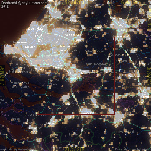
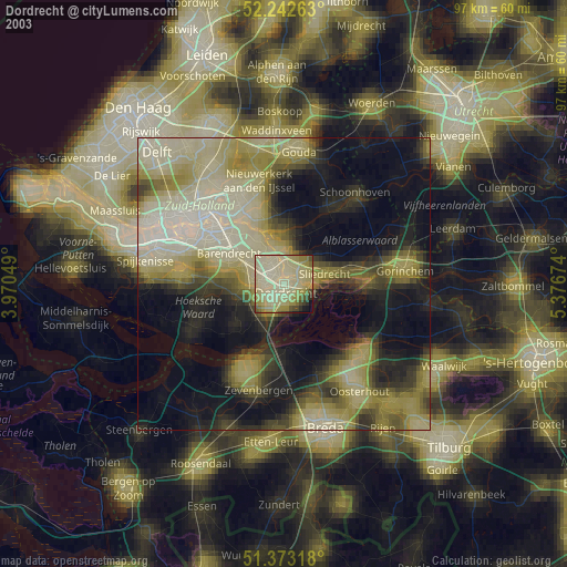
Dordrecht night lights from space
Night Light of Dordrecht (South Holland) from space (Netherlands) Src. Average luminocity for 10x10km area is 76.3641% and for 50x50km: 37.5776%.


Analysis of Dordrecht night lights 2016
Square area 10x10 km:
 26.89%
90-99
26.61%80-89
8.82%70-79
7.98%60-69
5.32%50-59
1.82%40-49
0.56%30-39
5.88%20-29
11.62%10-19
4.34%0-9
0.14%Square area 50x50 km:
12.56%90-99
9.58%80-89
3.02%70-79
2.83%60-69
3.09%50-59
2.25%40-49
2.54%30-39
3.78%20-29
7.58%10-19
16.16%0-9
36.63%Clear (daylight) street map image can be seen on geolist.org.
Map coordinates:
52° 14' 33.5" North, 3° 58' 13.8" East
51° 48' 36" North, 4° 40' 25" East
51° 22' 23.4" North, 5° 22' 36.3" East
Some cities around Dordrecht sort by population:
• Zwijndrecht
2.9 km =1.8 mi,  286°
286°
• Ridderkerk
8.5 km =5.3 mi,  325°
325°
• Papendrecht
2.6 km =1.6 mi,  21°
21°
• Sliedrecht
7.2 km =4.5 mi,  80°
80°
• Hendrik-Ido-Ambacht
4.5 km =2.8 mi, 327°
• Alblasserdam
6.3 km =3.9 mi,  352°
352°
• Nieuw-Lekkerland
8.8 km =5.5 mi,  5°
5°
• Slikkerveer
9.6 km =6 mi, 330°
2756669 (p: 119,260)
Sources (retrieved 2019-11-25):
» NASA, Earths city lights 1995
» NASA city lights 2003
» Earth at Night: Flat Maps 2012, 2016