Santo Domingo Zanatepec night lights from space
Night Light of Santo Domingo Zanatepec (Oaxaca) from space (Mexico) Src. Average luminocity for 10x10km area is 3.9793% and for 50x50km: 1.3387%.
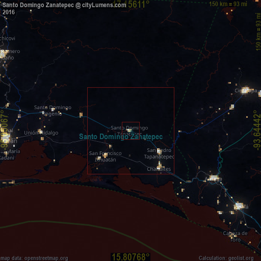
Analysis of Santo Domingo Zanatepec night lights 2016
Square area 10x10 km:
 0%
0%90-99
0.83%80-89
0.41%70-79
1.24%60-69
0.83%50-59
0.62%40-49
1.03%30-39
0%20-29
0%10-19
0.83%0-9
94.21%Square area 50x50 km:
0.01%90-99
0.31%80-89
0.17%70-79
0.27%60-69
0.14%50-59
0.16%40-49
0.19%30-39
0.18%20-29
0.28%10-19
0.14%0-9
98.15%Clear (daylight) street map image can be seen on geolist.org.
Map coordinates:
17° 9' 22" North, 95° 3' 2.4" West
16° 28' 59.1" North, 94° 20' 51.1" West
15° 48' 27.6" North, 93° 38' 39.9" West
Some cities around Santo Domingo Zanatepec sort by population:
• Arriaga
55.1 km =34.2 mi,  119°
119°
• Unión Hidalgo
51.4 km =31.9 mi,  268°
268°
• Chahuites
27.1 km =16.8 mi,  143°
143°
• Chahuite
26.9 km =16.7 mi, 139°
• Las Amilpas
31.5 km =19.6 mi,  245°
245°
• El Espinal
28.9 km =18 mi, 116°
• San Pedro Tapanatepec
20.6 km =12.8 mi,  127°
127°
• San Francisco Ixhuatan
20.7 km =12.9 mi,  224°
224°
3516837 (p: 7,249)
Sources (retrieved 2019-11-25):
» Earth at Night: Flat Maps 2012, 2016