Monterrey night lights from space
Night Light of Monterrey (Nuevo León) from space (Mexico) Src. Average luminocity for 10x10km area is 98.0739% and for 50x50km: 49.6505%.
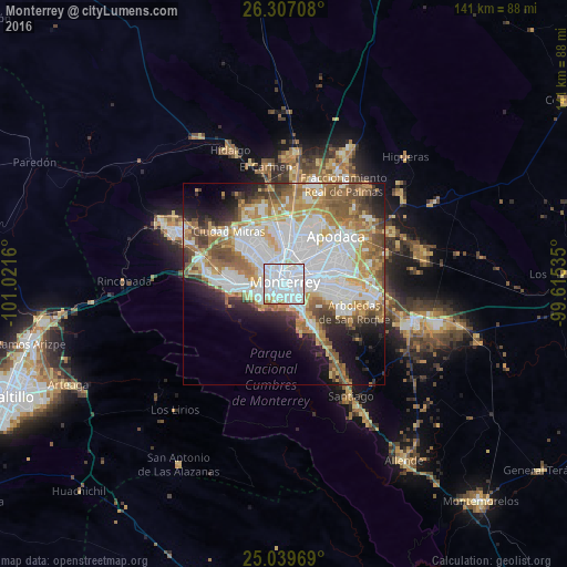
Analysis of Monterrey night lights 2016
Square area 10x10 km:
 65.15%
90-99
29.17%80-89
2.65%70-79
1.14%60-69
1.89%50-59
0%40-49
0%30-39
0%20-29
0%10-19
0%0-9
0%Square area 50x50 km:
15.6%90-99
11.02%80-89
5.17%70-79
6.4%60-69
7.22%50-59
6.52%40-49
4.38%30-39
3.64%20-29
5.07%10-19
8.06%0-9
26.92%Clear (daylight) street map image can be seen on geolist.org.
Map coordinates:
26° 18' 25.5" North, 101° 1' 17.8" West
25° 40' 30.3" North, 100° 19' 6.5" West
25° 2' 22.9" North, 99° 36' 55.3" West
Some cities around Monterrey sort by population:
• Guadalupe
6.2 km =3.9 mi,  88°
88°
• San Nicolás de los Garza
7.6 km =4.7 mi,  12°
12°
• Ciudad General Escobedo
13.6 km =8.5 mi,  0°
0°
• Santa Catarina
14 km =8.7 mi,  269°
269°
• San Pedro Garza García
9 km =5.6 mi,  259°
259°
• Jardines de la Silla (Jardines)
14 km =8.7 mi,  111°
111°
• Mitras Poniente
15.5 km =9.6 mi,  316°
316°
• Prados de Santa Rosa
16.5 km =10.3 mi,  33°
33°
3995465 (p: 1,135,512)
Sources (retrieved 2019-11-25):
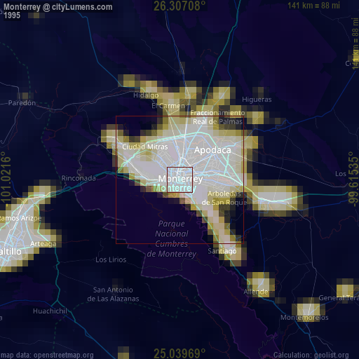
» NASA, Earths city lights 1995
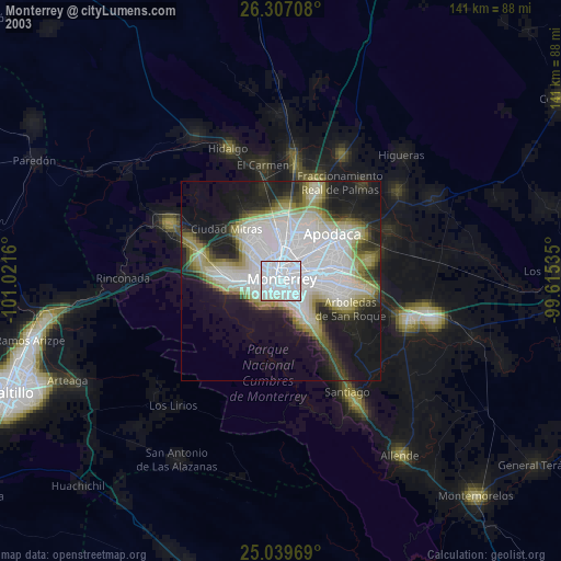
» NASA city lights 2003
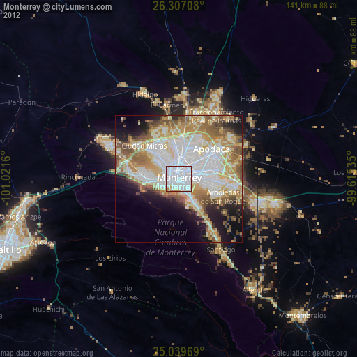
» Earth at Night: Flat Maps 2012, 2016